Snow in Leeds: Met Office warns ‘ice could be a hazard’ and issues further weather warning

and live on Freeview channel 276
The Met Office has issued a further weather warning as forecasters predict ice could be a hazard in places where snow has fallen across Leeds. The Met Office issued a yellow snow and ice warning across Leeds on Thursday March 9 but now it appears that ice is looking to be the cause for concern over the weekend.
The yellow ice warning has been put in place from 9.30am on Friday March 10, until tomorrow (March 11) at 10am. The Met Office website says “ice is likely to be a hazard where snow has fallen overnight.”
Advertisement
Hide AdAdvertisement
Hide AdMet Office forecasters warn there could be ‘some injuries from slips and falls on icy surfaces’ and ‘probably some icy patches on some untreated roads, pavements and cycle paths.’
Snow is then expected to fall again on March 11 from 8pm and a yellow snow and ice warning is then in place until 6am on Sunday, March 12. The warning comes as the Met Office warned yesterday (March 9) of heavy snow, and put an amber warning in place across Leeds.
Today, the city has woken up to a blanket of the white stuff which has caused chaos across Leeds. Flights have been delayed and cancelled at Leeds Bradford Airport, and parts of the M62 have been closed.
A number of schools in Leeds also closed early yesterday (Thursday) as snow began falling throughout the day and many have announced they will not be opening at all this morning (Friday). Others have announced that they will be opening later than usual or requesting students to work online at home.
Advertisement
Hide AdAdvertisement
Hide Ad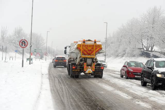

Earlier this week Met Office chief meteorologist Dan Suri said: “Snow, ice and low temperatures are the main themes of this week’s forecast, as the UK comes under the influence of an arctic maritime air mass as cold air moves in from the north.
“Snow is already falling in parts of the north where some travel disruption is likely, as well as a chance of some rural communities being cut off. Snow showers will continue through today and Tuesday here, and Northern Ireland will also be subject to some snow showers, especially over high ground.
“Ice will provide an additional hazard for many with overnight low temperatures well below 0°C for many. Further south wintry hazards will develop with parts of England and Wales affected by icy patches and snow in places tonight and likely further snow in parts of the south early Wednesday.”
Heavy snow warning - National Highways advice
Dale Hipkiss, national network manager at National Highways, said: “Keeping a kit of essential items like a torch and warm clothes, in your vehicle, can be vital in case you and your passengers become stranded in winter. Freezing conditions bring so many hazards such as snow and ice and take every possible step to understand your journey in advance and allow lots of extra time when travelling to prepare for the unexpected.
“It is therefore always important to plan ahead for your journey, listen to the weather forecasts, and if weather conditions become challenging, adjust your driving behaviour and take extra care.”
Comment Guidelines
National World encourages reader discussion on our stories. User feedback, insights and back-and-forth exchanges add a rich layer of context to reporting. Please review our Community Guidelines before commenting.