Snow in Leeds: Met Office issues further weather warning as cold snap continues into weekend

and live on Freeview channel 276
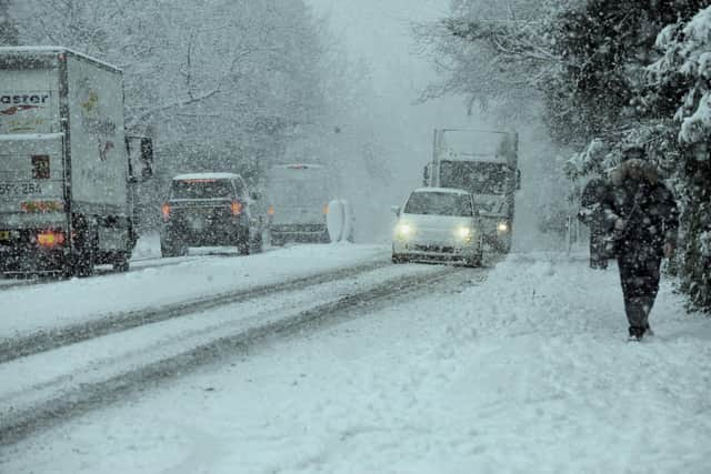
The Met Office has extended the snow and ice weather warning across Leeds this weekend as heavy snow is expected across the city. Parts of Leeds have seen snowfall over the past two days (March 8 and 9) but it looks like we will be seeing more of the white stuff as the Met Office predicts snowfall on Saturday and Sunday too (March 11 and 12).
The Met Office updated its weather alert this morning. At present an amber warning is in place until Friday (March 10), but the Met Office has now added a further yellow warning from Saturday at 3pm until Sunday at 6am.
Advertisement
Hide AdAdvertisement
Hide AdThe Met Office website says the further snowfall has the potential to cause disruption for the duration of the alert. It states public transport could be affected, there may be travel delays on roads, and some cycle paths and pavements might be impassable if not treated. There is also a small chance of power cuts along with the possibility of phone signals being affected.
At present an amber snow and ice weather warning is in place across Leeds. This means there could be periods of heavy snow causing disruption to travel and impacts on infrastructure.The Met Office website states: “There is a good chance that some rural communities could become cut off and power cuts are likely.”
Earlier this week Met Office chief meteorologist Dan Suri said: “Snow, ice and low temperatures are the main themes of this week’s forecast, as the UK comes under the influence of an arctic maritime air mass as cold air moves in from the north.

“Snow is already falling in parts of the north where some travel disruption is likely, as well as a chance of some rural communities being cut off. Snow showers will continue through today and Tuesday here, and Northern Ireland will also be subject to some snow showers, especially over high ground.
Advertisement
Hide AdAdvertisement
Hide Ad“Ice will provide an additional hazard for many with overnight low temperatures well below 0°C for many. Further south wintry hazards will develop with parts of England and Wales affected by icy patches and snow in places tonight and likely further snow in parts of the south early Wednesday.”
Heavy snow warning - National Highways advice
Dale Hipkiss, national network manager at National Highways, said: “Keeping a kit of essential items like a torch and warm clothes, in your vehicle, can be vital in case you and your passengers become stranded in winter. Freezing conditions bring so many hazards such as snow and ice and take every possible step to understand your journey in advance and allow lots of extra time when travelling to prepare for the unexpected.
“It is therefore always important to plan ahead for your journey, listen to the weather forecasts, and if weather conditions become challenging, adjust your driving behaviour and take extra care.”
Comment Guidelines
National World encourages reader discussion on our stories. User feedback, insights and back-and-forth exchanges add a rich layer of context to reporting. Please review our Community Guidelines before commenting.