
1974 was a year that Leeds becomes a metropolitan borough and work continued on the city’s Inner Ring Road. It was also a 12 months that residents voted in not one, but two, General Elections. These wonderful photos, a mix from the YEP archive and others published courtesy of photographic archive Leodis, which is run by Leeds Library & Information Service, chart a year in the life of your city. READ MORE: 33 closed Leeds pubs which will stir fond memories for drinkers LOVE LEEDS? LOVE NOSTALGIA? Join Leeds Retro on facebook
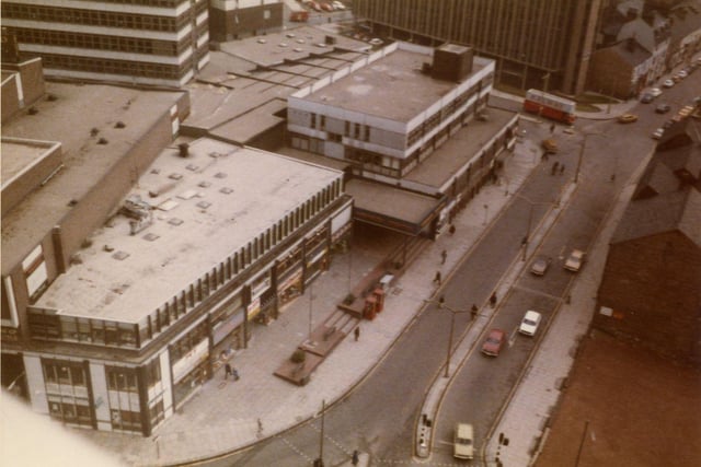
1. Leeds in 1974
A bird's eye view looking down on the roof tops of the Merrion Centre with Merrion Street on the right. Rising above the Merrion Centre on the left is the office block Wade House, while the tall building towards the top right is Fairfax House on Wade Lane. An area of land has been cleared at the bottom right; the buildings next to it would also eventually be demolished to make way for the St. John's Centre, opened in 1985. Photo: Leeds Libraries, www.leodis.net
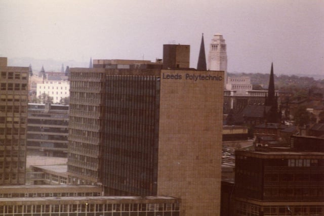
2. Leeds in 1974
An aerial view of buildings of Leeds Polytechnic on Portland Way. Formed in 1970, Leeds Polytechnic was granted university status in 1992 and became Leeds Metropolitan University. In September 2014 it was renamed Leeds Beckett University. The white tower of the Parkinson Building of Leeds University (the first university in the city) is seen in the background along with the spires of Emmanuel and Trinity Churches. Photo: Leeds Libraries, www.leodis.net
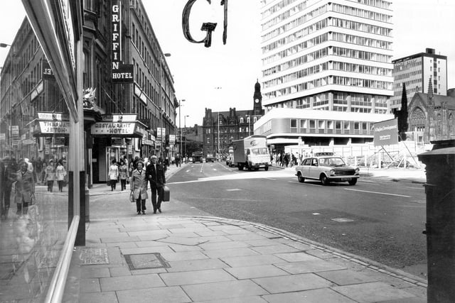
3. Leeds in 1974
Boar Lane looking west towards City Square in September 1974. On the left is the junction with Mill Hill, then the Griffin Hotel. On the right, demolition has taken place of the shops around Upper Mill Hill, in preparation for the development of the Bond Street Shopping Centre (now Leeds Shopping Plaza) which opened in 1977. Beyond this is Royal Exchange House, with, on the far right, a rare opportunity to see the rear of Mill Hill Chapel, and behind it the Norwich Union Building. Photo: Leeds Libraries, www.leodis.net
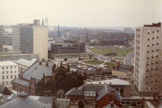
4. Leeds in 1974
An aerial view showing the area around Cookridge Street (foreground), Portland Way further back and Woodhouse Lane towards the right. The tall tower on the far right belongs to Kitson College of Technology, now part of Leeds City College, while in the background on the left are buildings of Leeds Polytechnic, now Leeds Beckett University. Further forward to the left of the centre is the former Gaumont Cinema, which after its closure in 1961 has been a Bingo Hall and TV Studio, then the Town and Country Club and later the Creation nightclub. Photo: Leeds Libraries, www.leodis.net
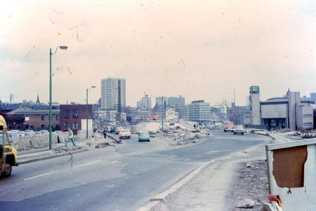
5. Leeds in 1974
Wellington Street looking in the direction of the city centre at the time of the construction of Stage 3 of the Inner Ring Road, the section from Westgate to Wellington Road. It was completed by February 1975. The clock tower of your Yorkshire Evening Post building is seen near the oncoming traffic to the right. The high rise block in the background is Marlborough Towers. Photo: Leeds Libraries, www.leodis.net
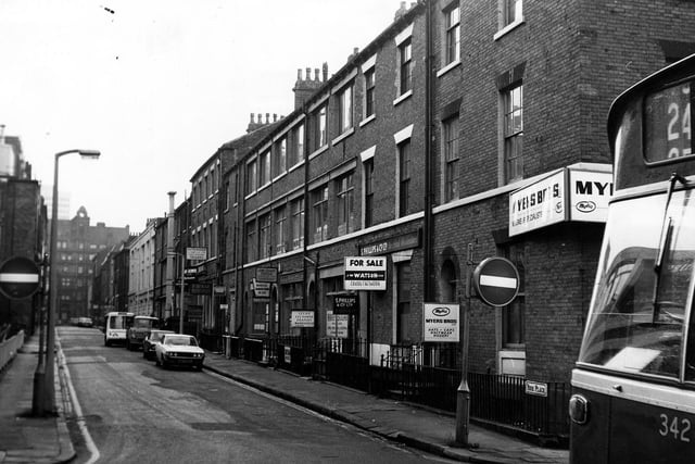
6. Leeds in 1974
Looking east along York Place from the junction with Queen Street in January 1974. Businesses in view include Myers Bros, Hat and Cap Merchants, Harry Sugar Textiles, Leeds Exchange Drapery Warehouse, Lewis Stuart Textiles and Hutchison Tailors. In the distance is the junction with King Street. Photo: Leeds Libraries, www.leodis.net