
Leylands was an area of Leeds, north of the city centre and west of Mabgate. A 1726 Plan of Leedes by cartographer John Cossins shows two fields marked Ley Lands north of Lady Lane and west of the Sheepscar Beck, also later known as Lady Beck, which correspond to the area. These wonderful photos take you back to the 1950s and showcase a slice of life which time seems to have erased. The images are a mix from the Tramway Museum Society and others published courtesy of photographic archive Leodis, which is run by Leeds Library & Information Service. READ MORE: 43 closed Leeds pubs which will stir fond memories for drinkers LOVE LEEDS? LOVE NOSTALGIA? Join Leeds Retro on facebook YEP NEWSLETTERS: Sign up for free news and sport emails
1. Leylands in the 1950s
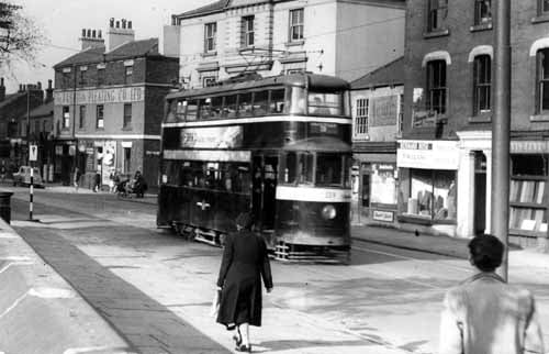
North Street showing Feltham tram no.559, on route 3 to Harehills. On the right is Levin & Levin, woollen merchants, at no.100 North Street, then Bernard Rose, tailor, at no.102. Hidden behind the tram is the North Tavern then following the junction with Darley Street is the Fashion Pleating Co. Ltd. Pictured in Photo: Tramway Museum Society
2. Leylands in the 1950s
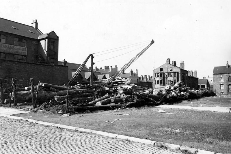
Looking north from Concord Street to Skinner Lane in September 1950. On the left is Abrahams, Wholesale Clothiers at no.31 Concord Street. In the middle and on the right are some terraced houses, some have broken windows. In the middle is a lumber yard with a crane in it. In the foreground is a cobbled street and waste land. Photo: Leeds Libraries, www.leodis.net
3. Leylands in the 1950s
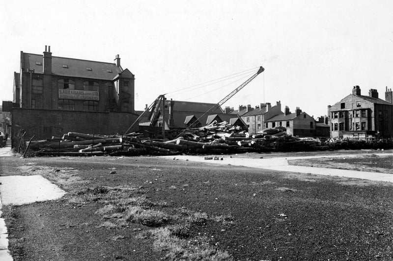
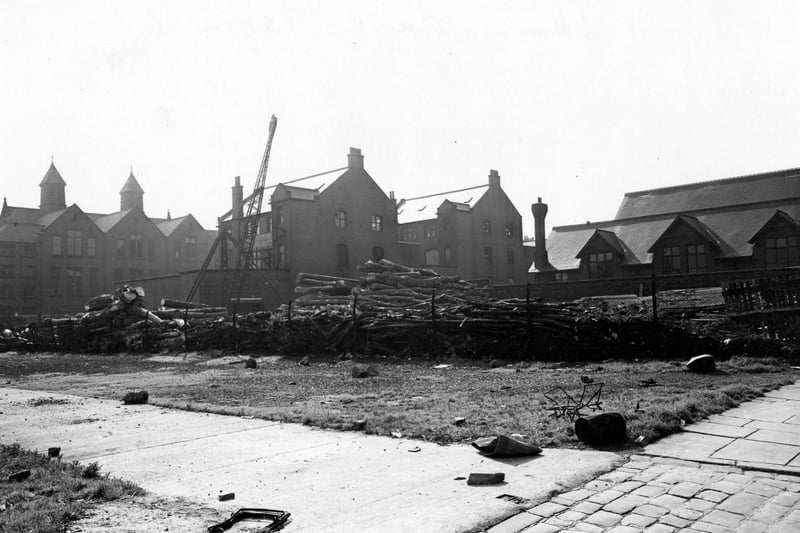
On the left is S. Abrahams (Leeds) Ltd., Wholesale Clothiers at no. 31 Concord Street. To the right is a row of terraced houses; the ones on the right have broken windows. Far right is Skinner Lane. In the middle is a lumber yard with a crane. In the foreground is waste ground. Pictured in September 1950 Photo: Leeds Libraries, www.leodis.net
4. Leylands in rhe 1950s
On the left is S. Abrahams (Leeds) Ltd., Wholesale Clothiers at no. 31 Concord Street. To the right is a row of terraced houses; the ones on the right have broken windows. Far right is Skinner Lane. In the middle is a lumber yard with a crane. In the foreground is waste ground. Pictured in September 1950. Photo: Leeds Libraries, www.leodis.net
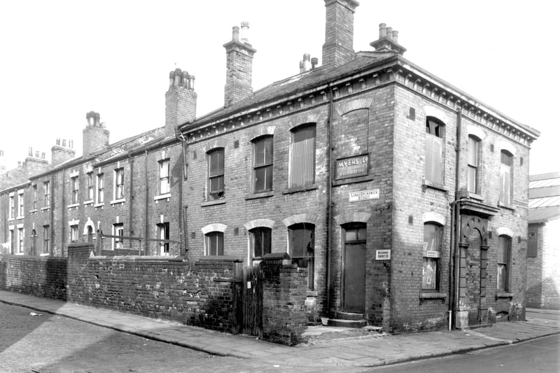
5. Leylands in the 1950s
This view looks from Bridge Street onto properties on Lower Brunswick Street. Numbers run from the left in ascending order to number 37 in the centre. On the right is a large commercial property which is now disused. This had been Brunswick Cottage facing onto Bridge Street although this entrance has been bricked up. The property had been used by Myers and Co, furriers and the Melbourne Cabinet Co. Photo: Leeds Libraries, www.leodis.net
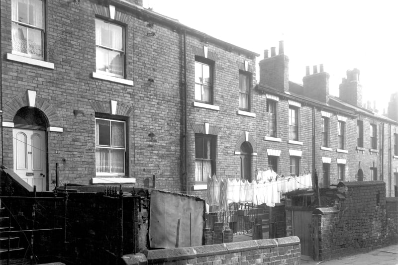
6. Leylands in the 1950s
Odd numbered back-to-back houses on Lower Brunswick Street in September 1959.. Numbers run to the right in ascending order from number 23 on the left. Houses have basement entrances and walled yards where washing lines have been put up. Photo: Leeds Libraries, www.leodis.net