


1963 is the focus of this collection of memories celebrating life around the town. Landmarks, shops, pubs and schools all fall under the spotlight during a year of change as slum clearance brought new hope and expectation. The images are published courtesy of the David Atkinson Archive whose collection is housed on photographic archive Leodis, which is run by Leeds Library & Information Service. READ MORE: Memories of lost Leeds pubs in Morley, Gildersome, Churwell and Drighlington LOVE LEEDS? LOVE NOSTALGIA? Join Leeds Retro on facebook YEP RETRO NEWSLETTER: Sign up for our free monthly email digest of Leeds nostalgia
13. Morley in 1963
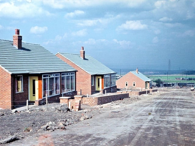
In the 1960s a large area of land between Church Street, New Bank Street, Victoria Road and King George Avenue was developed with semi-detached bungalow dwellings. Because it was near to H. H. Asquith's birthplace, Croft House, the region came to be known as the Croft House Estate. Here, the first road of the new development, Croft House Drive is being driven parallel to New Bank Street towards the old Plate Road. The rhubarb sheds and fields along the Plate Road can be seen in the distance behind the bungalows. On the left was Morley's original flower show ground which later housed Morley Nelson Cricket Club's field. This was the forerunner of Morley C. B. and A. Club along Scatcherd Lane. Photo: David Atkinson Archive
14. Morley in 1963
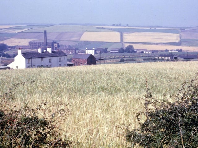
A field of ripening barley in Rooms Lane, Morley, near Cartlidge's turkey farm and probably being grown as feedstuff for the livestock. Lister Cottages (the white buildings) are at the side of Rooms Lane and in the background are St. Bernard's Mill and cottages in Gildersome. Pictured in August 1963. Photo: David Atkinson Archive
15. Morley in 1963
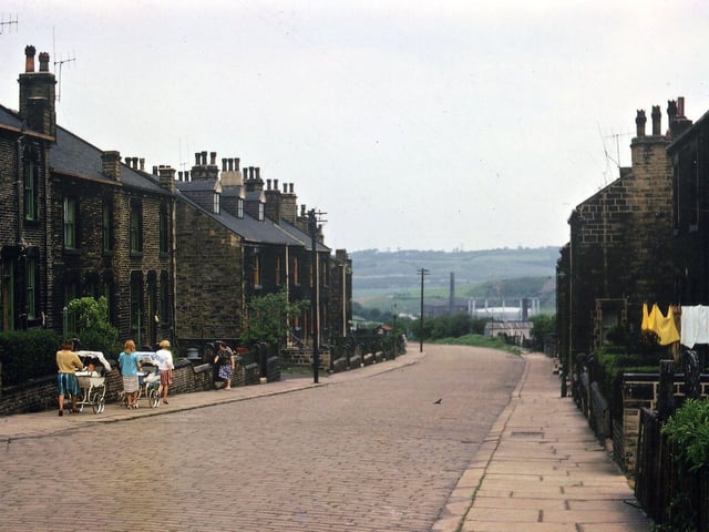
This photograph from May 1963 shows the late Victorian development of New Bank Street, Morley, where the cobblestones end and the road continues as a dirt track along Daisy Hill. The Valley Mill and old gasworks can be seen at the end of the street. Just before the point on the pavement where this picture was taken was a set of steps into Station Road which allowed people access to the Crank Mill and to Morley Low Station. At the time this photograph was taken the Croft House Estate was being developed behind the houses on the left, and also more of Daisy Hill, so that the roads in the area were considerably improved. Photo: David Atkinson Archive
16. Morley in 1963
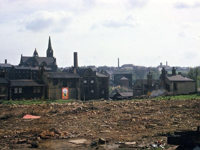
Looking towards Bank Street from Jackson Lane and across Webster's Yard after the whole area had been cleared of slum housing. Through the centre of the picture is a view to Troy Hill and the old Carriers Arms is still standing. Pictured in April 1963. Photo: David Atkinson Archive
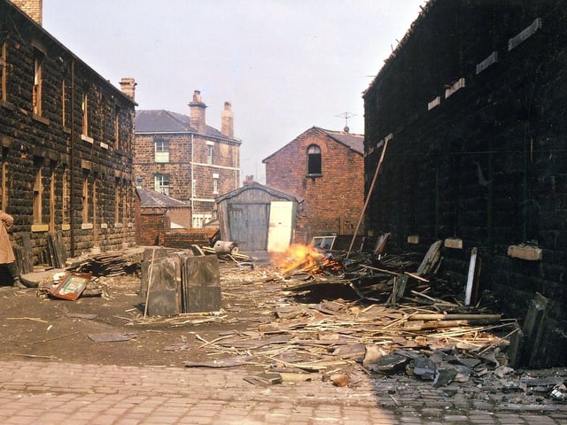
17. Morley in 1963
The demolition of slum property in the first yard to the left when proceeding down Jackson Lane from the post office at the corner of Victoria Road and Jackson Lane. At the time of the photograph the demolition workers were saving anything that would seem to have a market value - hence the the stocks of stone slabs in the centre of the yard. Part of the Prospect Hotel is seen through the end of it and the houses on the left were back-to-back with a row on Victoria Road. Pictured in May 1963. Photo: David Atkinson Archive
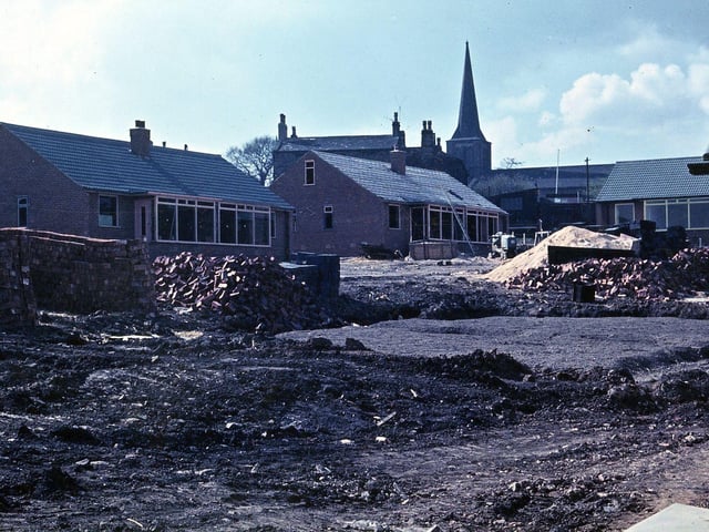
18. Morley in 1963
These bungalows on the Croft House Estate are being built on the field behind the Nelson Arms Hotel that,for 50 years after the enclosure of the Commons in 1818, were the centre of the community as the flower show ground and main cricket ground. Two matches were played here in 1862 and 1863 between the All England XI and XXII of Morley and District. Pictured in May 1963, Photo: David Atkinson Archive