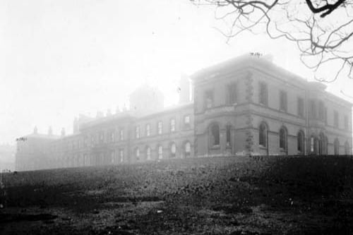
Before health care became the responsibility of government, local or national, charities made some provision for medical aid. A house of recovery would take in victims of infectious diseases. In the 19th century as population increased, the insanitary overcrowded living conditions contributed to outbreaks of disease. The larger house of recovery seen here - Beckett Street (Hospital) was built in 1846, in what was then a rural area. Patients were brought in were isolated. This photo is one of 15 charting a year in the life of Leeds in 1905, a year which your city was building for the future. The images are published courtesy of photographic archive Leodis, which is run by Leeds Library & Information Service. They also run heritage blog The Secret Library Leeds, which provides a behind the scenes look at the Central Library and highlights from its special collections, including rare books hidden away in the stacks. READ MORE: 16 evocative photos showcase a corner of Leeds which time forgot LOVE LEEDS? LOVE NOSTALGIA? Join Leeds Retro on facebook YEP RETRO NEWSLETTER: Sign up for our free monthly email digest of Leeds nostalgia
1. Burmantofts
A house of recovery on Vicar Lane would take in victims of infectious diseases. In the 19th century as population increased, the insanitary overcrowded living conditions contributed to outbreaks of disease. The larger house of recovery seen here was built in 1846, in what was then a rural area, patients brought in were isolated in an attempt to arrest the spread of infection, by the 1880s the facilities were inadequate, the recovery house was replaced by Seacroft Hospital. Photo: Leeds Libraries, www.leodis.net
2. Harehills
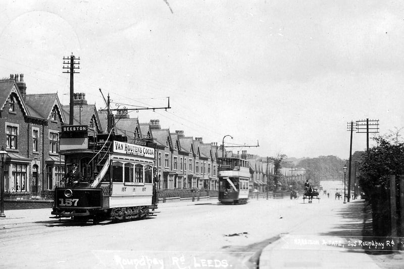
A postcard view of Roundhay Road with a postal date of August 25, 1905. A row of terraced housing is seen from the left while two trams are on the road including open-top no. 157 in front bound for Beeston. Photo: Artemis, Leeds City Council
3. Leeds city centre
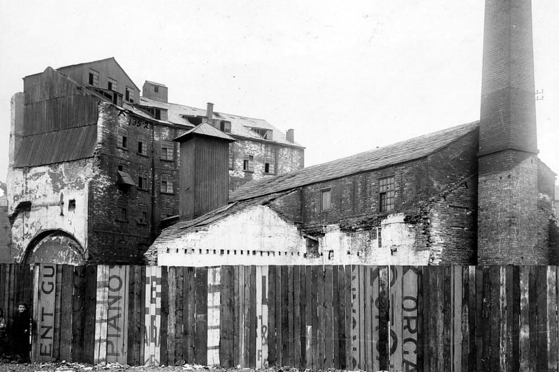
Part of the Swinegate Sovereign Street Improvement area pictured in July 1905. Mill and factory buildings can be seen. Corn mills were numerous in this area, including the historic Kings Mills. The River Aire powered water wheels to grind the corn. Until 1839 Leeds people were obliged to have their corn ground at the Kings Mill. A carved stone is set onto the riverbank to mark the site. Photo: Leeds Libraries, www.leodis.net
4. Holbeck
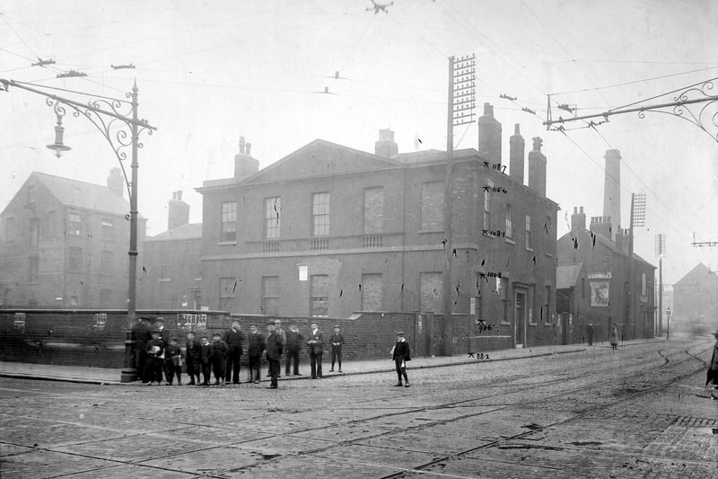
A view of junction of Meadow Lane (Left) with Great Wilson Street. A group of boys and men stand on corner. Pictured in July 1905. Photo: Leeds Libraries, www.leodis.net
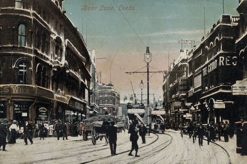
5. Leeds city centre
A postcard view looking east along Boar Lane. On the left, by the junction with Albion Street, is Wilsons Ltd., gas cookers and stoves. On the right, after the junction with Alfred Street, is the Grand Restaurant, with Fairburn's White Horse Restaurant further along. Many people are out and about despite a covering of snow on the ground. Photo: Artemis, Leeds City Council
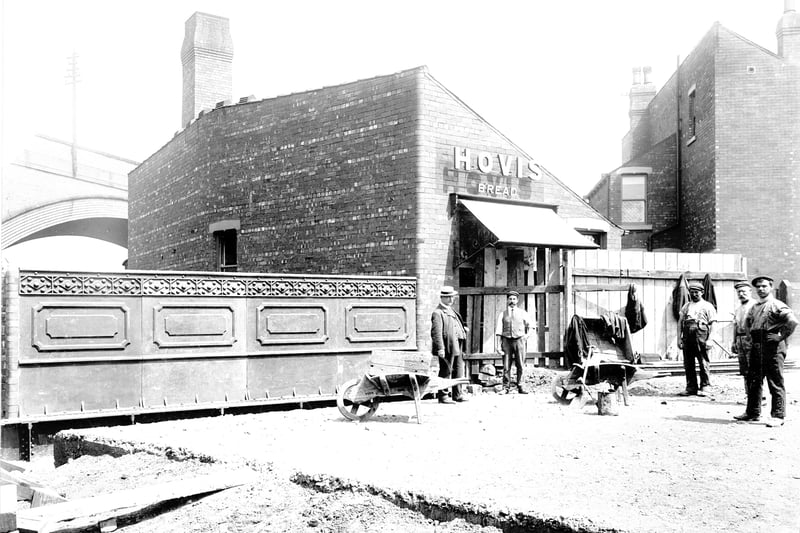
6. Holbeck
Workmen pose for the camera as they are laying down the surface to a bridge across Low Beck in July 1905. Photo: Leeds Libraries, www.leodis.net