
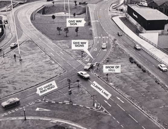


Claypit Lane was driving motorists to distraction in the mid-1970s. This photo shows how car swerves to avoid another as it crosses the give way junction. Many motorists on the minor road failed to realise that they must give way - or perhaps drive into two lanes of fast moving traffic. This was 1975, with the image one of 25 charting the year in the life of your city and its residents. It was a 12 months which witnessed huge progress on the city’s inner ring road. The images are a mix from the YEP archive and others published courtesy of photographic archive Leodis, which is run by Leeds Library & Information Service. They also run heritage blog The Secret Library Leeds, which provides a behind the scenes look at the Central Library and highlights from its special collections, including rare books hidden away in the stacks. READ MORE: The story of a quirky Leeds pub LOVE LEEDS? LOVE NOSTALGIA? Join Leeds Retro on facebook YEP RETRO NEWSLETTER: Sign up for our free monthly email digest of Leeds nostalgia
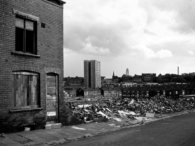
7. Woodhouse
Marian Terrace in Woodhouse in the process of demolition in July 1975. There is a clear view through to Holborn Towers multi-storey flats, with one of the Jubilee streets still there in front of it. The Parkinson tower of Leeds University is seen in the background. | Leeds Libraries, www.leodis.net Photo: Leeds Libraries, www.leodis.net
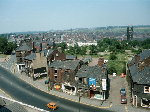
8. Woodhouse
Woodhouse taken from Leeds University Engineering Department in Jun e 1975. Woodhouse Lane runs across in the foreground, with Spenceley Street on the right and Raglan Road leading off on the left. Volume One bookshop is seen in the centre in part of a block of derelict buildings due to be demolished. To the left of this is the Pack Horse public house. St. Mark's Church is seen in the background on the right while on the far left is the corner of Woodhouse Moor. | Leeds Libraries, www.leodis.net Photo: Leeds Libraries, www.leodis.net
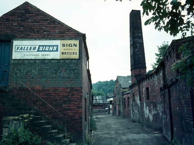
9. Meanwood
Derelict buildings of Woodlands Dyeworks on Wood Lane shortly before demolition in July 1975. Known as Crowther's Mill and previously Rowley's Mill and Wood's Mill, there is believed to have been a mill on the site since 1601. | Leeds Libraries, www.leodis.net Photo: Leeds Libraries, www.leodis.net
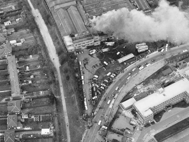
10. Crossgates
An aerial view of Cross Gates Carriage Works on Manston Lane, the firm of Charles H. Roe. A small fire is being attended to by several engines in March 1975. Nine metro buses worth £120,000 each had to be pushed to safety. | Leeds Libraries, www.leodis.net Photo: Leeds Libraries, www.leodis.net
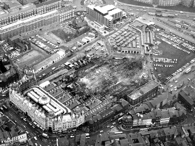
11. Leeds city centre
An aerial view looking across the destruction caused by a fire in Kirkgate Market, seen in the direction of the Eastgate roundabout in December 1975. Around four acres of the site was destroyed in a blaze which took 110 fireman two hours to control. Most of the 1857 section of the market was destroyed although the 1904 frontage onto Vicar Lane was saved. | Leeds Libraries, www.leodis.net Photo: Leeds Libraries, www.leodis.net
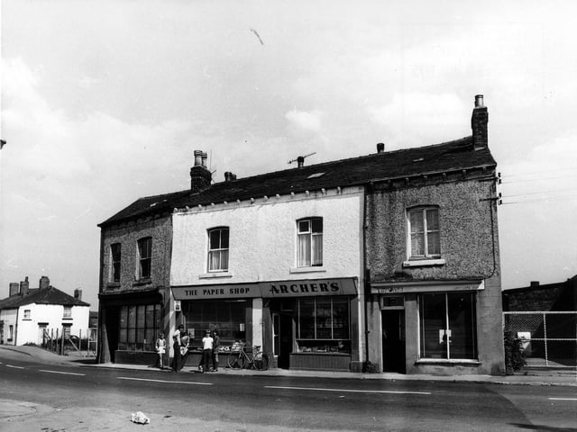
12. East Ardsley
A group of children are pictured in front of Archer's 'the paper shop' on Main Street in July 1975. | Leeds Libraries, www.leodis.net Photo: Leeds Libraries, www.leodis.net