


Leeds is a city that never stands still, and these fascinating pictures reveal how dramatically its streets have been transformed over more than half a century.
They show just some of the buildings, including several well-known landmarks, to have been demolished over the years.
Those buildings are either pictured between 1950 and 1999 or were demolished between these dates. Most are shown still standing, but others are seen already being reduced to rubble.
Some have only recently been consigned to history, while others are already a distant memory.
The lost landmarks featured in this retro photo gallery include the Imperial Hotel, which stood on Briggate for 80 years before closing its doors for good in March 1961 and being demolished.
Pictured too is Leeds Central Station, which served passengers for more than a century, between 1854 and 1967, before being razed, with a Royal Mail sorting office built in its place.
Many people will also remember the architecturally striking Leeds International Pool at Westgate, which opened in 1967 and lasted four decades before closing in 2007 and being flattened two years later.
The hulking Quarry Hill Flats also dominated Leeds’ skyline for many years. Built in the 1930s and housing 3,000 people, it was said to be the largest and most modern social housing complex in Europe at the time. The flats were demolished in 1978, with Leeds Playhouse being built on the site.
A more recent casualty of time’s shifting sands was Tetley’s brewery on Hunslet Road, pictured here in the 60s, with two of its famous shire horses ready to pull a beer-laden dray. The brewery closed in 2011, and most of the site was demolished the following year, but the iconic art deco Tetley building survived and was transformed into an art gallery.
A 60s secondary school, a famous shopping arcade, an old fire station, and two pubs demolished to make way for the Inner Ring Road are just some of the other lost buildings featured in this trip down memory lane.
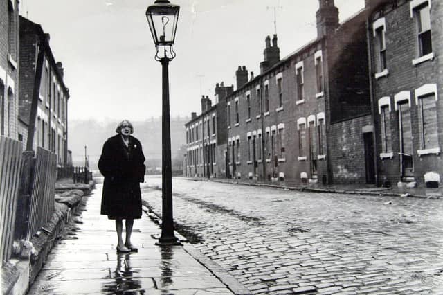
But perhaps the most striking image shows the last resident of a cobbled street standing alone amid the deserted row of houses shortly before they were demolished in the name of progress.
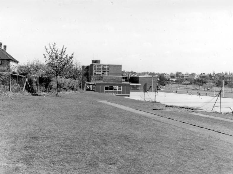
7. Moor Grange County Secondary
Moor Grange County Secondary, which opened in 1960 as a boys' school in LS16 at the junction of Parkstone Avenue and the West Park section of the Leeds Ring Road. It was later renamed Moor Grange High School in the 70s, before being demolished a decade later.
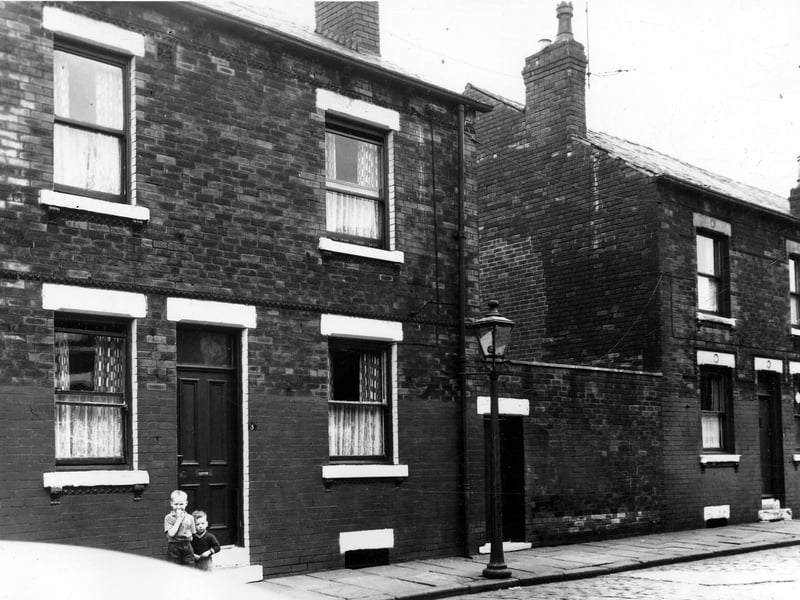
8. Back-to-backs
Two back-to-back terraced house separated by a yard, originally built to house the shared outside toilet, in August 1963. On the left two small boys stand outside no 3. This area was soon to be demolished and families relocated as part of a Leeds City Council slum clearance programme.
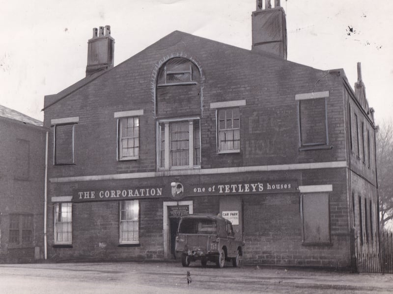
9. The Corporation
The Corporation, on Camp Road in Hunslet, pictured in November 1964, before it was demolished as part of Leeds Council's redevelopment plans. It was one of the last houses in Leeds to brew its own beer. | YPN
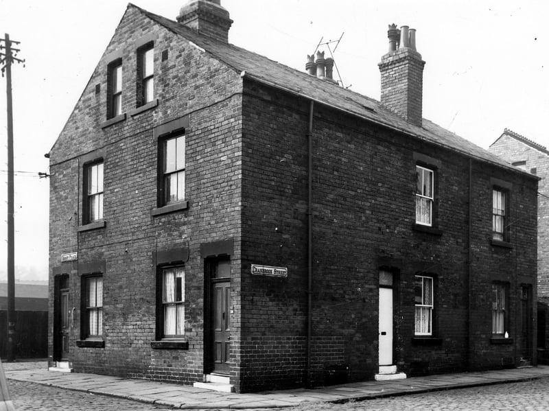
10. Mount Place
Mount Place on the left with Vicar Street visible behind in September 1964. On the right are nos 1 to 3 Cranbrook Street, two back-to-back terraced houses with a yard on the right originally built to house a shared outside toilet. These houses were soon to be demolished and families relocated under a Leeds City Council slum clearance programme.
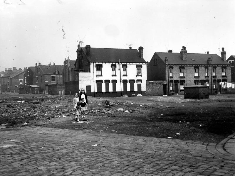
11. Vicar Street
Vicar Street, Leeds, viewed across a section of waste ground towards Selborne Place. Four children of varying ages stand in the centre of the photo, taken in September 1964. The terraces seen on the far left are Berwick Place and Berwick Terrace, and the white building behind the children is number 16 Selborne Place, the Progressive Christian Spritual Church. On the right is a yard and numbers 10 to 14 Selborne Place. These houses were soon to be demolished and families relocated under a Leeds City Council slum clearance | West Yorkshire Archive Service
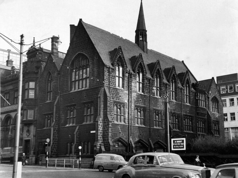
12. Priestley Hall
Priestley Hall, on Park Row, Leeds, in January 1965, before it was demolished to make way for a new bank | YPN