When will Storm Dennis hit Leeds? Hour by hour forecast for extreme weather this weekend
and live on Freeview channel 276
Here is an hour by hour forecast for this weekend:
SATURDAY
7AM

7 degrees - 58% chance of rain
8AM
8 degrees - 49% chance of rain
9AM
9 degrees - 58% chance of rain
10AM
10 degrees - 58% chance of rain
11AM
11 degrees - 58% chance of rain
12PM
12 degrees - 58% chance of rain
1PM
12 degrees - 66% chance of rain
2PM
12 degrees - 49% chance of rain
3PM
12 degrees - 66% chance of rain
4PM
12 degrees - 71% chance of rain
5PM
12 degrees - 71% chance of rain
6PM
12 degrees - 71% chance of rain
7PM
13 degrees - 67% chance of rain
8PM
12 degrees - 67% chance of rain
9PM
12 degrees - 67% chance of rain
________________________________________
SUNDAY
7AM
7 degrees - 70% chance of rain
8AM
7 degrees - 70% chance of rain
9AM
7 degrees - 70% chance of rain
10AM
7 degrees - 74% chance of rain
11AM
7 degrees - 74% chance of rain
12PM
7 degrees - 74% chance of rain
1PM
7 degrees - 40% chance of rain
2PM
8 degrees - 34% chance of rain
3PM
8 degrees - 37% chance of rain
4PM
7 degrees - 47% chance of rain
5PM
6 degrees - 51% chance of rain
6PM
6 degrees - 47% chance of rain
7PM
6 degrees - 0% chance of rain
8PM
5 degrees - 0% chance of rain
9PM
5 degrees - 0% chance of rain
The arrival of Storm Dennis comes just a week after Storm Ciara battered parts of the country, bringing winds of up to 97mph.
Met Office meteorologist Matthew Box said inland gusts could reach 50mph by Saturday afternoon, rising to 80mph in exposed areas in the south and west.
Advertisement
Hide AdAdvertisement
Hide AdHe said: "The winds will be a touch down on what we saw with Ciara but the focus is on a bit more rain with Storm Dennis due to the persistence of the rain."
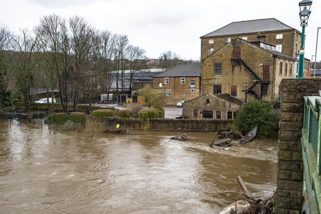
Higher locations could have rainfall levels of 50mm to 80mm over the course of the weekend, potentially rising to 140mm in some parts, Mr Box said.
More widely, rain totals could be around 20mm to 40mm, with the Environment Agency urging people to check for flood warnings.
It said preparations were under way to operate flood defences, flood storage reservoirs and to put up temporary barriers to protect communities.
Advertisement
Hide AdAdvertisement
Hide AdThis includes the Foss Barrier in York, the Thames Barrier in London and another in Bewdley, Worcestershire, on the River Severn.
Caroline Douglass, flood duty manager at the Environment Agency, said: "Remember to never drive or walk through floodwater, just 30cm of flowing water is enough to move your car - it's not worth the risk."
Mr Box said the start of half term for some children this weekend means families should plan ahead or consider delaying their travels.
He warned rain could help topple sodden trees, affecting power lines, while strong winds could affect transport links such as ferries.
Advertisement
Hide AdAdvertisement
Hide AdThe AA has urged the public to follow safety advice on the roads, with Ben Sheridan, AA patrol of the year, saying: "Take extra care when passing high-sided vehicles, cyclists and motorbikes, and watch out for sudden gusts, which can blow debris, trees and even damaged vehicles into your path."
Passengers are strongly advised to check via National Rail Enquiries or with their train operator before travelling and allow more time for their journeys.
Matt Rice, Route Director for Network Rail's North and East Route, said: “I would like to reassure passengers across Yorkshire and the North East that we will have extra teams on hand this weekend to keep services moving.
“We are working closely with train operators to minimise any impact which Storm Dennis has as it has the potential to bring some localised flooding and disruption to services.
Advertisement
Hide AdAdvertisement
Hide Ad“We strongly advise passengers to allow plenty of time for their journeys, as they may take longer than usual. People should also check via National Rail Enquiries or with their train operator before travelling.”