This is when the River Aire is expected to peak as Storm Dennis hits Leeds
and live on Freeview channel 276
A Met Office yellow weather warning is in place for the city and the Flood Information Service has warned flooding is possible along stretches of the River Aire.
The flood alerts are expected to be upgraded to flood warnings overnight, according to Kirsktall ward councillor Fiona Venner.
Advertisement
Hide AdAdvertisement
Hide AdShe said: "We do now have a flood alert for the River Aire, but this is not expected to become a flood warning until the early hours of Sunday morning – the River Aire is expected to peak at around 7.30am tomorrow morning (Sunday).
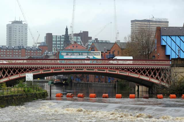

"Last weekend, we did not have a repeat of 2015 when the river peaked, so, we will, hopefully, avoid such devastation again.
"The flood gates at Holbeck were closed at 12pm as a precaution. The weirs, which were effective last week, will be lowered if needed.
"The Flood Incident Room is up and running. Kirkstall is being closely monitored, along with Allerton Bywater and Otley, though in the region Bradford and Calderdale (again!) are at most risk.
Advertisement
Hide AdAdvertisement
Hide Ad"There is regular communication between the incident room, emergency services and a battalion of council officers who are working across the city to monitor the situation and respond to any emergencies."
Leeds City Council chief executive Tom Riordan tweeted: "There are likely to be flood alerts for parts of Leeds appearing later.
"This means trigger levels have been reached as rainwater flows down from upper catchments of the rivers, rather than the whole city being inundated."