Thunder and lightning warning for Leeds and Yorkshire extended to fourth day
and live on Freeview channel 276
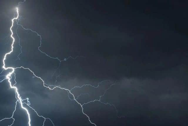
Earlier, the Met Office had issued a yellow weather warning for thunderstorms, in place from Monday to Wednesday.
The forecaster has warned of possible risk to life due to localised flash flooding as well as power cuts and damage to businesses.
Advertisement
Hide AdAdvertisement
Hide AdBut now the warning has been extended to a fourth day, meaning it's set to be a truly miserable week of weather after the recent sunshine.

After a scorching, sizzling weekend with some of the hottest temperatures of the year, it seems that the weather is set to take a turn for the worse.
The forecaster says some places are 'likely to see severe thunderstorms', and there could be localised flooding, lightning strikes, damage to buildings and large hail.
The Met Office also said that there is a slight chance power cuts could occur, and that fast flowing or deep floodwater could cause a danger to life.
What the Met Office says about thunderstorms
Advertisement
Hide AdAdvertisement
Hide AdSome places are likely to see severe thunderstorms early next week - but there is significant uncertainty in location and timing.
There is a small chance that homes and businesses could be flooded quickly, with damage to some buildings from floodwater, lightning strikes and large hail.
Where flooding or lightning strikes occur, there is a chance of delays and some cancellations to public transport.
Spray and sudden flooding could lead to difficult driving conditions and increased chance of accidents.
Advertisement
Hide AdAdvertisement
Hide AdThere is a slight chance that power cuts could occur and other services to some homes and businesses could be lost
There is a small chance of fast flowing or deep floodwater causing danger to life
What is the forecast for Leeds?
A mix of cloud and rain on Monday with temperatures maxing out at about 25C.
On Tuesday, the temperature will actually increase to 27C, where it will stay throughout Tuesday and into Wednesday. So there could still be plenty of hot, clammy restless nights ahead.
Advertisement
Hide AdAdvertisement
Hide AdThe temperature is then set to drop on Thursday, but the risk of thunder and lightning, as well as heavy rain and even hail, remains.
The Met Office itself admits that it isn't clear exactly when the thunderstorms are set to crackle into our skies, which is why it has issued a wide-reaching warning which is a touch vague on timing.
Although there isn't any specific day or time that the thunder could strike, Leeds could reasonably expect thunderstorms at any point between Monday and Thursday.
Otherwise, the forecast is hot with spells of rain and cloud.
What is the forecast across Yorkshire?
Advertisement
Hide AdAdvertisement
Hide AdThe outlook is similar across Yorkshire, with a three-day thunder warning in place in Hull, Sheffield, Ripon, York, Bradford and Wakefield among other areas.
Today:
Morning low cloud and mist will slowly clear back to coasts with a chance of the odd shower. Warm, sunny spells are likely in the afternoon, but with heavy showers possibly breaking out into the evening. Cooler near coasts. Maximum temperature 21 °C.
Tonight:
Becoming increasingly cloudy, with heavy and perhaps thundery showers moving northward overnight, these clearing the north of the region shortly after midnight. Minimum temperature 14 °C.
Monday:
Mostly bright and sunny with partly cloudy skies. Feeling very warm with heavy thundery showers, especially in the west. Overnight it will be humid with light winds and further thunderstorms. Maximum temperature 25 °C.
Outlook for Tuesday to Thursday:
Variable cloud with sunny spells expected, and feeling very warm with heavy thundery showers likely. The nights will become humid with lighter winds. Likely cooler and cloudier near coasts.
Comment Guidelines
National World encourages reader discussion on our stories. User feedback, insights and back-and-forth exchanges add a rich layer of context to reporting. Please review our Community Guidelines before commenting.