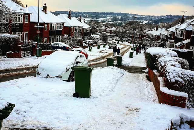
More snow and ice forecast in Leeds as yellow weather warning issued by Met Office


The warning is in place from 8am Wednesday to 9pm on Thursday night and is in place for Leeds, as well as all of Yorkshire and the Humber.
The Met Office forecast for Leeds in full - will it snow again in Leeds this week?
Forecast in full:
Advertisement
Hide AdAdvertisement
Hide AdRain moving slowly eastwards, turning to sleet and snow overnight.
Today: A dry and frosty start to the day with some hazy sunshine. Becoming cloudy during the afternoon, with patchy light rain pushing eastwards whilst falling onto frozen surfaces, giving a significant risk of ice, particularly over higher ground. Maximum temperature 3 °C.
Tonight: Rain becoming heavier and persistent during the evening, turning gradually to sleet at low levels but snow over high ground. Some significant accumulations expected. A cold night. Minimum temperature 0 °C.
Thursday: Outbreaks of rain, snow over high ground, slowly easing through the morning whilst becoming confined to the west. Some bright spells likely in East Yorkshire by the afternoon. Remaining cold. Maximum temperature 3 °C.
Advertisement
Hide AdAdvertisement
Hide AdOutlook for Friday to Sunday: Cold on Friday, with early morning frost and isolated fog patches. Windy with heavy rain on Saturday morning. Breezy though largely dry thereafter, with occasional sunshine Saturday afternoon and Sunday.
Heavy snow may affect parts of the warning area, with possible significant travel disruption.
What to expect:
Possible travel delays on roads stranding some vehicles and passengers, especially across higher routes, with potential for road closures.
Possible delays or cancellations to rail and air travel
Power cuts may occur and other services, such as mobile phone coverage, may be affected
Untreated pavements and cycle paths might be dangerous or even impassable, posing a greater risk of injuries and accidents.
Comment Guidelines
National World encourages reader discussion on our stories. User feedback, insights and back-and-forth exchanges add a rich layer of context to reporting. Please review our Community Guidelines before commenting.