Met Office Leeds weather: This is when heavy showers will hit Leeds after days of sunshine
and live on Freeview channel 276
We've seen highs of 29C in Leeds this week - and those temperatures are set to continue today (Thursday).

It's left many people reaching for their fans and battling sleepless nights as they battle to nod off in the heat.

Advertisement
Hide AdAdvertisement
Hide AdFriday is forecast to be slightly cooler but still warm, with highs of 23C, according to the Met Office
If you're begging for some cooler weather then you're in luck at the weekend.
Saturday is set to get cooler again - an overcast day seeing highs of 20C.
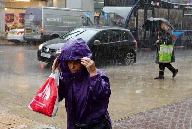
It's on Sunday that we may finally see some rain as heavy showers move across the UK.
Advertisement
Hide AdAdvertisement
Hide AdThe Met Office has issued a yellow weather warning for rain for a large swathe of England at the weekend - but it only reaches as far up as the Midlands.
Nevertheless, we're still forecast rain.
According to the Met Office's Leeds forecast, it could hit as early as 7am on Sunday, with the biggest chance of rain coming during the late afternoon and into early evening.
Here is the full forecast for Leeds for the next few days:
Thursday: Sunny - highs of 29C
Friday: Overcast changing to sunny in the late afternoon - highs of 23C
Saturday: Overcast - highs of 20C
Sunday: Heavy showers - highs of 21C
Monday: Sunny intervals changing to light showers by late morning - highs of 22C
Advertisement
Hide AdAdvertisement
Hide AdTuesday: Sunny intervals changing to light showers in the afternoon - highs of 21C
Here is the long range UK forecast for Monday, July 26 to Wednesday, August 4:
"An unsettled start to the period, especially across eastern parts of the UK where some slow moving and heavy showers are likely, these possibly thundery at times.
"The best of the drier and sunnier conditions will be towards the west at first. Conditions are likely to become more generally unsettled by mid-week.
Advertisement
Hide AdAdvertisement
Hide Ad"Temperatures are likely to dip back to near normal to warm for most, particularly in the northwest of the UK.
"From the end of next week until early August, we will likely see changeable conditions with a mix of sunny spells and heavy showers, perhaps with some more prolonged rain at times.
"Currently, there is no preference towards any particular area seeing one regime dominate. Temperatures around average."
Support the YEP and become a subscriber today. Enjoy unlimited access to local news and the latest on Leeds United. With a digital subscription, you see fewer ads, enjoy faster load times, and get access to exclusive newsletters and content. Click here to subscribE
Comment Guidelines
National World encourages reader discussion on our stories. User feedback, insights and back-and-forth exchanges add a rich layer of context to reporting. Please review our Community Guidelines before commenting.