Hour-by-hour Met Office forecast as more heavy rain to hit Leeds over night
and live on Freeview channel 276
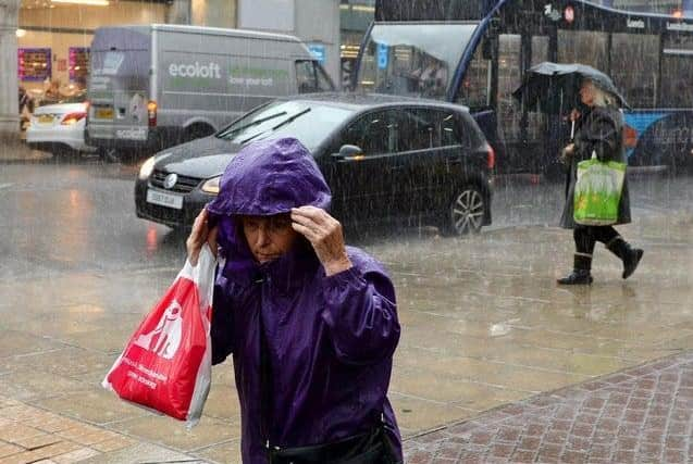
Heavy rain fell across Leeds on Wednesday as an amber warning for rain has been put in place by the Met Office until Thursday.
An amber warning means there is an increased likelihood of severe weather, which can cause travel delays, road closures and power cuts.
Follow here for live updates.

Wednesday's forecast:
5pm - overcast - 10C
6pm - light rain - 10C
7pm - heavy rain - 10C
8pm - light rain - 10C
9pm - heavy rain - 9C
10pm - heavy rain - 7C
11pm - heavy rain - 5C
Thursday's forecast:
12am - light rain - 4C
1am - overcast - 4C
2am - overcast - 3C
3am - light rain - 3C
4am - heavy rain - 3C
5am - cloudy - 3C
6am - heavy rain - 3C
7am - heavy rain - 3C
8am - heavy rain - 3C
Advertisement
Hide AdAdvertisement
Hide AdAn urgent flood warning was issued for Collingham on Wednesday morning as the River Wharfe swelled after persistent rainfall.
Residents living at the lower end of Collingham Beck near the River Wharfe were urged to take 'immediate action'.
They were told to move belongings, family and pets upstairs or to safety and move their car to a safe place.
There are also three additional flood alerts in place across Leeds, where residents at risk are advised to activate their flood defences and 'be prepared'.
Advertisement
Hide AdAdvertisement
Hide AdThe alerts were issued for the River Middle Aire catchment, which runs through Leeds, the Lower River Wharfe and Wyke Beck, Meanwood Beck and Wortley Beck.
The Environment Agency has been monitoring nine areas in Leeds where river levels have risen above the flooding threshold, meaning flooding is likely in the River Aire at Kirkstall Abbey; River Aire at Leeds Crown Point; River Aire at Holbeck; Wyke Beck; River Aire at Knostrop Weir; Aire Washlands at Oulton St Aidans; River Wharfe at Arthington; River Wharfe at Collingham; River Wharfe at Pool Bridge.
By 8:30am, the River Wharfe had already begun to overflow into a children’s play park and skate park which were covered in water.
The towpath by the River Aire in Leeds city centre has also already flooded.
Advertisement
Hide AdAdvertisement
Hide AdSimon Partridge, a Met Office forecaster, explained: “It’s not a traditional sort of storm, it’s going to be windy but it’s not based on the wind strength at all, it’s really down to the disruption that’s being caused by rain."
Mr Partridge said the storm meant that some areas could see double the average amount of monthly rainfall over a few days.
He said: “Those areas that have seen between 50mm and 70mm already, the warning is out until midday on Thursday, so an extremely long period, but by then we could see up to 150mm to possibly 200mm of rainfall."
What to expect in Leeds, according to the Met Office
Advertisement
Hide AdAdvertisement
Hide Ad- Homes and businesses are likely to be flooded, causing damage to some buildings
- Fast flowing or deep floodwater is likely, causing danger to life
- Delays and some cancellations to train and bus services are likely
- Spray and flooding probably leading to difficult driving conditions and some road closures
- A good chance some communities cut off by flooded roads
- Power cuts and loss of other services to some homes and businesses likely
Comment Guidelines
National World encourages reader discussion on our stories. User feedback, insights and back-and-forth exchanges add a rich layer of context to reporting. Please review our Community Guidelines before commenting.