Heavy rain to batter Leeds as yellow weather warning issued
and live on Freeview channel 276
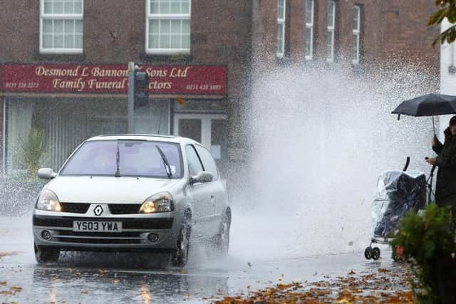
There is an 80% chance of heavy rain on Tuesday morning from 7am, moving to lighter rain from 8am through to 1pm, but make no mistake it will be a wet old morning.
But the worst of the rain will hit Leeds from Thursday, with the warning remaining in place all Thursday and Friday.
What the warning says:

Advertisement
Hide AdAdvertisement
Hide AdProlonged rain through Thursday and overnight into Friday may bring disruption from flooding.
What to expect
There is a small chance that homes and businesses could be flooded, causing damage to some buildings
Where flooding occurs, there is a slight chance of delays or cancellations to train and bus services
Spray and flooding could lead to difficult driving conditions and some road closures
Advertisement
Hide AdAdvertisement
Hide AdThere is a small chance that some communities become cut off by flooded roads
The weekend
Saturday should start cold and frosty for most, with patches of fog expected in central and eastern England, which may be slow to clear.
A band of rain and cloud is expected to move eastwards across the country into the evening, bringing strengthening winds for most and potential hill snow in the north. Sunday and Monday will most likely continue to be unsettled, and this theme will probably remain throughout the following week. Looking ahead to the later part of the period, although confidence is currently low, some snow is possible in the north, mainly over the hills, whilst the heaviest rainfall is likely to be concentrated across central and southern England. For most parts, it will remain colder than average throughout this period.