First heavy snow fall blasts Yorkshire as these dramatic photos and video show


After days of forecasts for flurries, the first flakes have fallen in Yorkshire as these dramatic photos from Thomas Beresford show.
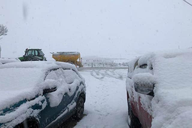
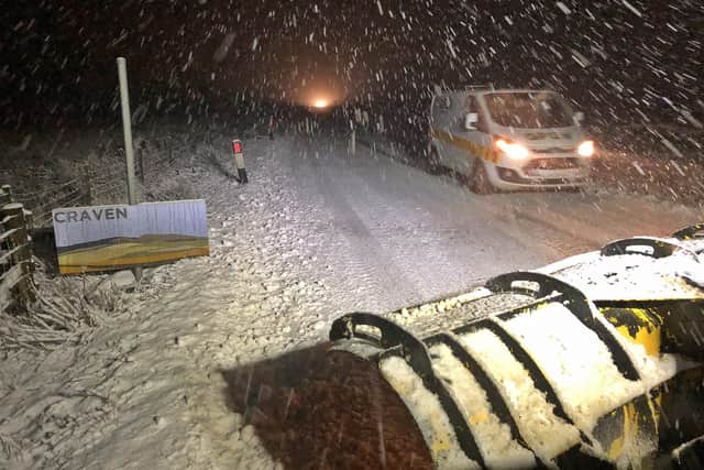
Gritters were out in force in North Yorkshire on Wednesday night after heavy snow began to batter the county.
Advertisement
Hide AdAdvertisement
Hide AdBut it clearly wasn't enough to stop the snow settling and within hours cars were grinding to a halt.
Tractors with snow ploughs were then spotted on the snowy country roads this morning.
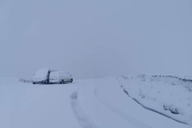
Newby Head Pass in North Yorkshire, which connects the county with Cumbria, saw three inches of snow by Thursday morning.
Fleet Moss in North Yorkshire was also blanketed in heavy snow.
But is Leeds likely to see any snow just yet?
This is the forecast for Leeds:
Advertisement
Hide AdAdvertisement
Hide AdThursday: After a chilly and bright start, cloud will increase from the west to bring outbreaks of rain during the afternoon, perhaps turning wintry on the hills. Rain is likely to become more persistent during the evening. Feeling colder. Maximum temperature 4 °C.
Tonight: Cloudy with further showers or longer spells of rain, heavy at times. The rain perhaps turning wintry on the hills. Winds will be freshening later in the night. Cold. Minimum temperature 2 °C.
Friday: Further showers or longer spells of rain, heavy at times, during Friday. Rain turning to snow on the hills, especially early in the day. Windy and feeling rather cold. Maximum temperature 6 °C.
What about the UK forecast?
The Met Office has issued a snow & ice warning for parts of Scotland valid from 1800 this evening until 1200 on Thursday, along with an ice warning for Northern Ireland.
Advertisement
Hide AdAdvertisement
Hide AdChief Meteorologist at the Met Office, Dan Suri said: “It’ll certainly feel more wintry this week, with colder weather bringing a risk of frost, ice and wintry showers.
"The risk of snow accumulating is largely confined to the northern half of the UK - mainly over higher ground in Scotland, Wales and northern England.
“By Thursday morning parts of northwest Scotland could see 2cm of snow accumulations to low levels, with 2-5cm above 200m and up to 10cm gathering over the highest routes, leading to some travel disruption.”
The Met Office outlook for Friday (4 Dec) to Sunday (6 Dec) says it will be “Very unsettled; generally cloudy, rather cold and windy, with showers or longer spells of rain. Snow expected over hills and perhaps to lower levels at times, mainly in the north.”
Advertisement
Hide AdAdvertisement
Hide AdSteve Ramsdale, Chief Meteorologist at the Met Office, said: “Although we’re going to see a few days with colder conditions, we shouldn’t be surprised that the start of winter brings a brief spell of wintry weather.
“Some parts of the UK, especially northern hills, may see snow, but for many this will only be short lived.”
However, the Met Office adds, “There is also the chance of some snow to lower levels in places later in the week though away from hills it is currently uncertain exactly where snow will fall.
“In the clear periods between bands of wintry showers, frosts are likely and these could be sharp or even severe in prolonged clear conditions in north-western parts of the UK.
Comment Guidelines
National World encourages reader discussion on our stories. User feedback, insights and back-and-forth exchanges add a rich layer of context to reporting. Please review our Community Guidelines before commenting.