
How Leeds has spent hundreds of millions protecting itself after the devastating Boxing Day floods of 2015

A decade on from the worst flooding in Leeds for hundreds of years, measures are still being taken and lessons being learned.
The Boxing Day floods of 2015 saw waterways burst their banks across the city, causing a staggering half a billion pound’s worth of damage throughout the region.
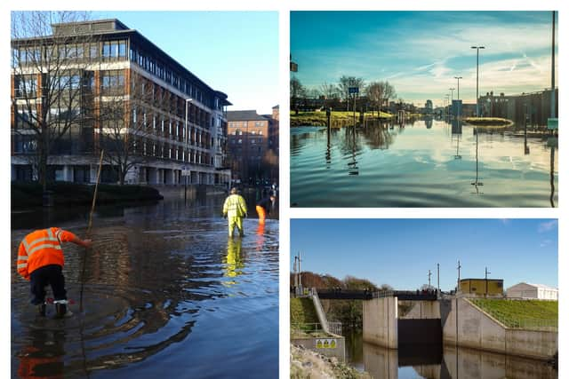

Millions more has since been spent on preventative measures by Leeds City Council and the West Yorkshire Combined Authority (WYCA), with guarantees given that if such a deluge were to happen again then the city would be mitigated.
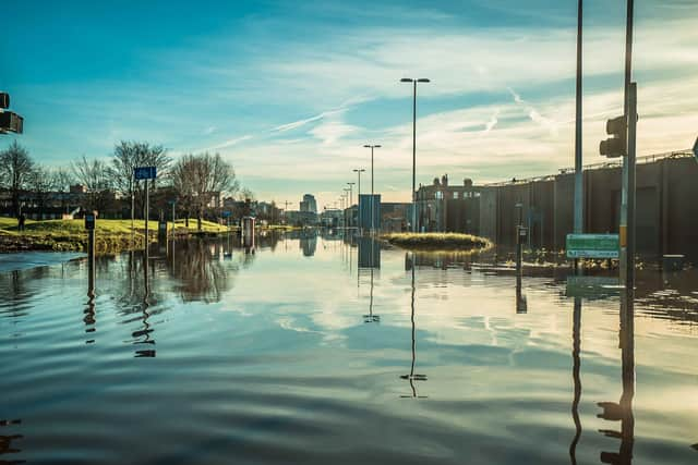
As people celebrated the festive season, Storm Eva caused the River Aire to reach its highest ever level of 5.2m following weeks of heavy rain. The river, which has a normal flow rate of 15 tonnes per second, saw an unprecedented 360 tonnes of water per second flowing through it. The storm conditions led to the three waterways in Leeds, the River Aire, the River Wharfe, and the Aire and Calder Navigation to become overwhelmed.
The resulting flood waters affected fourteen Leeds wards and caused devastating damage to over 2600 homes, 650 businesses, and impacted key infrastructure such as power substations, communications systems, and parts of the road and rail network.
In monetary terms, it is estimated that the floods cost Leeds £36.8m in direct costs and the wider region over £500m to clean up. However, the impact on the physical and mental health of residents and business owners was incalculable.
After the flood waters receded, work immediately began on assessing the damage and reopening infrastructure. Over 1000 volunteers helped with the clean-up, reflecting the community spirit in affected areas across the city.

Ten years on from these devastating events, flood resilience in Leeds has never been stronger, following the completion of the Leeds Flood Alleviation Scheme, along with several smaller projects across the city.
Working with partners including the Environment Agency and West Yorkshire Combined Authority (WYCA), Leeds City Council has directly completed the £200m project to protect 4000 homes, 1000 businesses, and safeguard 33,000 jobs across the city to a 1-in-200-year standard of protection.
FAS 1
The first phase of the Leeds Flood Alleviation Scheme, known as FAS 1, was completed in 2017.
Protecting the city centre, FAS 1 stretches from Leeds Station to Woodlesford. The works involved merging the River Aire and canal at Knostrop Cut, building a range of new walls and embankments that still allow waterfront access, and using two innovative movable weirs at Knostrop and Crown Point, that can be lowered independently to temporarily create more space in the channel. The weir technology used is the first of its kind deployed in the UK.

FAS 2
Phase two saw the introduction of several miles of linear flood defences, the introduction of several new pumping stations and flow control structures, and the construction of a huge flood storage area near Calverley.
The new storage area, which is operated through raising two large flood gates, has an embankment of 200m in length and a height of 6.2m, meaning it can store the equivalent of over 720 Olympic-sized swimming pools’ worth of water when needed, which can be slowly released once the danger has passed.
Other measures
In addition to the flood alleviation infrastructure, a team of flood experts and engineers are on standby around the clock, 365 days a year, to operate and maintain the flood defences.
A wider programme of smaller flood alleviation projects has also been completed around the Leeds district including schemes in Garforth, Wyke Beck, Mickletown Pit Lane, Otley and Sheepscar. Several more are planned, including works at Meanwood Beck, Thorner Beck, Millshaw Beck, and Wortley Beck.

Aire Resilience Company
Alongside the infrastructure and engineering works within Leeds, a new organisation called the Aire Resilience Company, an innovative community interest company (CIC), has been set up to create a sustainable business model to install and maintain one of the largest natural flood management schemes in the country, complementary to the hard infrastructure measures.
Through a consortium of Leeds businesses, funding has been sought to plant up to 750,000 trees and 1240ha of land management in the upper River Aire catchment area, to slow the flow of water from the source of the river and maintain the standard of protection of the Leeds FAS against climate change into the future.