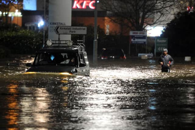
Leeds floods video: Kirkstall Road ‘like a river - people can’t believe what they’re seeing’


Kirkstall Road, near the Vue cinema, was closed to traffic as water deluged the area.
Trains between the city and Skipton and Ilkley were cancelled, and flooding was reported as far out as Weetwood.
Advertisement
Hide AdAdvertisement
Hide AdAs the full extent of the emergency became apparent, residents organised impromptu cleanups.
But a large-scale clean-up planned for Kirkstall had to be postponed, with the main road through the area still “under water”.
Coun Lucinda Yeadon had issued a rallying cry for volunteers to help the owners of homes and businesses on Kirkstall Road affected by the flooding.
She was expecting a good turn-out from people in the area, amid a huge outpouring of goodwill on social media.
Advertisement
Hide AdAdvertisement
Hide AdBut she said: “We’ve had to put it off for today because Kirkstall Road is under water. At the moment we’re planning on rearranging it for Monday instead, but we’ll just need to keep monitoring the situation.
“The businesses are going to need a lot of work.”
Kirkstall Road remained closed to traffic today.
Some of the worst affected businesses were on the parade of shops opposite the Cardigan Fields leisure park, where the Vue cinema, among others, was shut last night.
Sheesh Mahal restaurant and Woodrup Cycles were both flooded.
On Facebook, Woodrup Cycles wrote: “Thanks for all your kind messages about the ongoing flooding in the Kirkstall area.
Advertisement
Hide AdAdvertisement
Hide Ad“We’re still unable to access the shop at the moment to asses the damage. I’ll update as soon as we’re able too. Thanks again for all the kind words of support, it really is appreciated.”
Coun Yeadon added: “For the established businesses there who have spent so many years building up there livelihoods it’s devastating. It’s incredibly sad.”
BBC reporter Lauren Potts tweeted video of flooding on Kirkstall Road, saying it was “like a river - people gathering to look, they can’t believe what they’re seeing”.
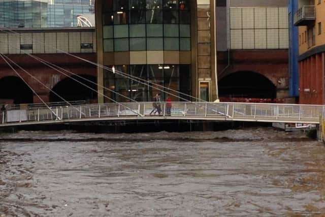
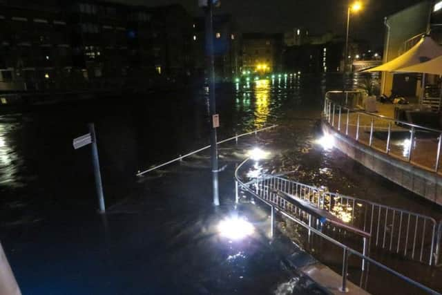
Environment Agency officials had issued a “red warning” - the highest alert - for parts of the city centre including Sovereign Street, The Calls and Clarence Dock.
Advertisement
Hide AdAdvertisement
Hide AdThe River Aire at Leeds Crown Point, usually at a height of 0.9 metre had risen to 2.95 metres at 1am, its previous high was 2.45 metres recorded in June 2007. Officials warned that it could yet reach its highest point at 4am.
Other areas affected include Neptune Street, Sovereign Street, Asda House and Canal Wharf including the Brewery.
A severe flood warning was also been issued for the River Aire at Cardigan Trading Estate and Savins Mill Way.
The agency said the severe alert warning was due to “significant impacts to infrastructure and risk to life in the area”.
Advertisement
Hide AdAdvertisement
Hide AdThe Environment Agency said they have experienced “record levels in the Aire catchment” and the peak was due at around 11pm on Sunday.
A statement on the agency’s website added: “This is the highest ever record and higher than in 2007.
“We are working with police and other partners to maintain public safety.
“We are also supporting a multi-agency response.
“We are closely monitoring the situation from the Leeds Incident Room which is open.”
Advertisement
Hide AdAdvertisement
Hide AdA major power outage had also been reported which was affecting Sovereign Street to The Calls, the southern half of Briggate. Dock Street and Asda House, although swift work from engineers, power was soon restored.
Leeds Central MP Hilary Benn Tweeted: “Thanks to everyone who is working so hard tonight to deal with the flooding in Leeds.”
While his thoughts were echoed by the Leeds City Council who also sent out this message on social media: “Thanks again to everyone working hard to tackle flooding. Some great examples also of community spirit. See @EnvAgencyYNE for updates.#leeds”
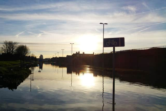
Flooding has also affected other parts of Leeds including Kirkstall, Otley and Wetherby.
For more details and latest flood alerts visit https://flood-warning-information.service.gov.uk/map