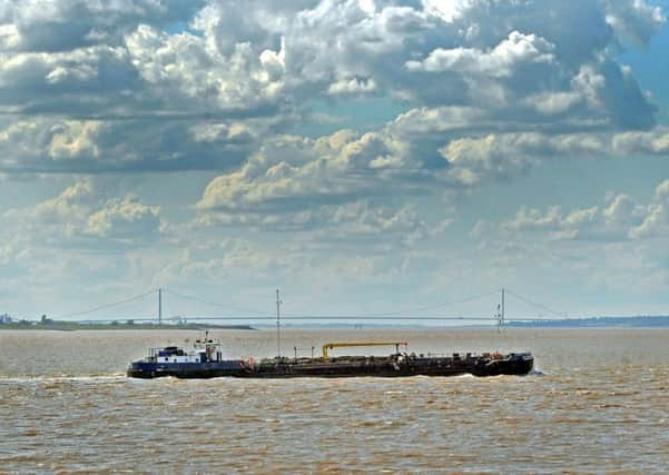
A 100-year fight to chart Humber's trade course


The Humber Estuary is now the largest port complex in the country, with its ports and wharves handling 14 per cent of the UK’s international trade. There are 40,000 ship movements a year, while industries along the estuary include oil refinery complexes, power stations and chemical works. The estuary has also been designated as a Special Area of Conservation and is recognised as one of the most important estuaries in Europe for over-wintering birds.
But for a long time, the estuary was actually seen as a barrier to trade development because of the lack of a bridge or tunnel to join the two banks together.
Advertisement
Hide AdAdvertisement
Hide AdThe first major crossing proposal dates back to 1872, more than 100 years before the now-famous Humber Bridge actually opened. The plan back in the 19th century, put forward by local merchants and businessmen, was for a tunnel scheme but this never came to fruition.
The local council then drew up an ambitious scheme in the 1920s to create a multi-span bridge four miles to the west of Hull, but the impact of the Great Depression meant the project had to be dropped.
Approval for construction of a suspension bridge was granted in 1959 but work did not actually begin on it for a further 14 years in 1973. Hundreds of workers were employed on the project, which took eight years to complete and involved thousands of tonnes of steel and concrete.
Finally the bridge was completed in the summer of 1981, with the Queen travelling to Humberside to formally open it.
Advertisement
Hide AdAdvertisement
Hide AdThe bridge has opened up two previously remote areas of England and acted as a key driver for the local economy, by saving commercial vehicles and ordinary members of the public millions of miles and hours of travelling.
Technical details: Nikon D3s camera with 80-200mm lens, exposure of 1/1000th sec @ f8, ISO 250.