The full list of roads closed in Leeds during the Tour de Yorkshire


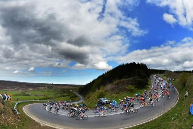
MOT test changes: the strict new rules being introduced in May that could affect your carThe spectacle kicks off for stage one in Beverley on Thursday, May 3 and takes in Ilkley, Doncaster, Barnsley and Scarborough among other towns before the grand finale in Leeds on Sunday, May 6.
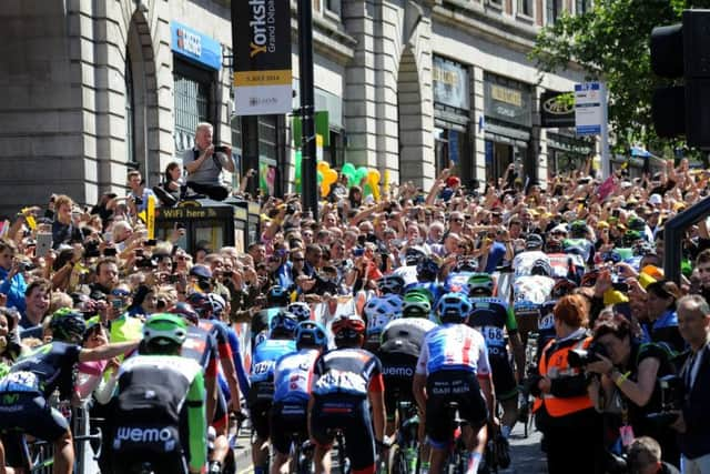
The Tour passes through Leeds on Friday, May 4 taking in areas such as Otley and passing Harewood House, before the rip roaring conclusion on The Headrow in the city centre – on exactly the same spot as where the Tour de France started in 2014, on Sunday.
Advertisement
Hide AdAdvertisement
Hide AdAll race timings can be found by visiting: https://letour.yorkshire.com/information/timingsBelow is a list of road closures that cover the whole weekend, but predominantly Friday and Sunday, as well as temporary speed limits, one way diversions and parking and stopping restrictions.
(All roads are whole roads unless otherwise stated)
Friday, May 4
These roads will only be closed for as long as required to allow each race to pass. The closure will be put in place by the police who are escorting the race. The race caravan will travel on open roads and the police will hold traffic at stopping points along the route as determined by the event organisers. Closures for the caravan will be approximately 10 minutes duration.
All of the below roads will have a rolling road block between 10.15am and 6.30pm and will be closed for as long as required:

A656 Barnsdale Road, Leeds/Wakefield Boundary to Longdike Lane
B6137 Longdike Lane
B6137 High Street
B6137 Leeds Road
A63 Selby Road, Leeds Road to Lidgett Lane
B6137 Lidgett Lane
B6137 Main Street
Town End, Aberford Road to Barwick Road
Barwick Road
Long Lane
Leeds Road
Main Street
Station Road
Scholes Lane
A64 York Road, Scholes Lane to Thorner Lane
Advertisement
Hide AdAdvertisement
Hide AdLower Sandhills
Main Street
Church View
Milner Lane
Holme Farm Lane, Milner Lane to Mill Lane
Mill Lane, Holme Farm Road to Rigton Green
Rigton Green, Mill Lane to Rigton Bank
Rigton Bank
Keswick Lane
Wike Lane, Keswick Lane to Main Street
Main Street
Lumby Lane
A659 Harewood Avenue
A659 The Avenue
A61 Harrogate Road, The Avenue to the North Yorks boundary at Harewood Bridge
Note: The race route passes into North Yorkshire along Harrogate Road, Weeton Lane, Main Street, Wescoe Hill Lane, Castley Lane and A658 Harrogate Road returning into the Leeds City Council area over Pool Bridge. This section of the route is included in the Traffic Regulation Order promoted for the event by North Yorkshire County Council.
A658 Main Street, Pool
A658 Pool Bank New Road, Main Street to Old Pool Bank
Old Pool Bank FIXED CLOSURE
A660 Leeds Road, Old Pool Bank to Leeds Road
Leeds Road, A660 Leeds Road to Gay Lane
Gay Lane
Bondgate
Kirkgate
Manor Square
Clapgate
Bridge Street
Billam’s Hill
Weston Lane
READ: Price cut pledge for shoppers as Sainsbury’s and Asda plan to come together under Walmart bannerAdditional closures to effect race and crowd safety
Advertisement
Hide AdAdvertisement
Hide AdThese roads will be closed to traffic, except for essential access, for the period stated below.
Old Pool Bank, Pool Pool Bank New Road to Leeds Road 6am to 6.30pm
Woodacre Lane, Bardsey 9.30am to 3pm
People are prohibited from stopping or towing between midnight and 6.30pm on the following roads:
A656 Barnsdale Road, Leeds/Wakefield Boundary to Longdike Lane
B6137 Longdike Lane
B6137 High Street
B6137 Leeds Road
A63 Selby Road, Leeds Road to Lidgett Lane
B6137 Lidgett Lane
B6137 Main Street
Town End, Aberford Road to Barwick Road
Barwick Road
Long Lane
Leeds Road
Main Street
Station Road
Scholes Lane
A64 York Road, Scholes Lane to Thorner Lane
Thorner Lane
Lower Sandhills
Main Street
Church View
Milner Lane
Holme Farm Lane, Milner Lane to Mill Lane
Mill Lane, Holme Farm Road to Rigton Green
Rigton Green, Mill Lane to Rigton Bank
Rigton Bank
Keswick Lane
Wike Lane, Keswick Lane to Main Street
Main Street
Lumby Lane
A659 Harewood Avenue
A659 The Avenue
Advertisement
Hide AdAdvertisement
Hide AdA61 Harrogate Road, The Avenue to the North Yorkshire boundary at Harewood Bridge
A658 Main Street, Pool
A658 Pool Bank New Road, Main Street to Old Pool Bank
Old Pool Bank, Pool Bank New Road to Leeds Road
A660 Leeds Road, Old Pool Bank to Leeds Road
Leeds Road, A660 Leeds Road to Gay Lane
Gay Lane
Bondgate
Kirkgate
Manor Square
Clapgate
Bridge Street
Billam’s Hill
Weston Lan
All of the below roads will have a rolling road block between 3.30pm and 6.30pm and will be closed for as long as required:
These roads will only be closed for as long as required to allow the race to pass. The closure will be put in place by the police who are escorting the race. The race caravan will travel on open roads and the police will hold traffic at stopping points along the route as determined by the event organisers. Closures for the caravan will be approximately 10 minutes duration.
Advertisement
Hide AdAdvertisement
Hide AdNewall Carr Road, Leeds / North Yorks Boundary to Billams Hill
Billams Hill
Bridge Street
Clapgate
Manor Square
Kirkgate
Bondgate
Gay Lane
East Chevin Road FIXED CLOSURE
Bramhope Old Lane
Old Lane
A658 Pool Bank New Road
A659 Arthington Lane, Pool Bank New Road to Black Hill Road
Black Hill Road FIXED CLOSURE
Arthington Road FIXED CLOSURE
Arthington Road, Black Hill Lane to Eccup Lane
Eccup Lane, Arthington Road to Church Lane
Church Lane
A660 Otley Road, Church Lane to New Adel Lane
New Adel Lane
Otley Old Road, New Adel Lane to Spen Lane
Spen Lane
A6120 Ring Road West, Park Spen Lane to Spen Lane
Spen Lane
Abbey Walk
A65 Abbey Road, Abbey Walk to Bridge Road
B6157 Bridge Road
Wyther Lane
Armley Ridge Road, Wyther Lane to Cockshott Lane
Cockshott Lane
A647 Stanningley Road, Cockshott Lane to Ledgard Way
Ledgard Way
Canal Road, Ledguard Way to Viaduct Road
Viaduct Road
Burley Place
Willow Road
Burley Road, Willow Road to Burley Street
Burley Street
Park Lane FIXED CLOSURE
Westgate FIXED CLOSURE
The Headrow FIXED CLOSURE
FEATURE: Stopping the mobile menace: in the cab with police’s undercover truckersAdditional road closures to effect race and crowd safety:
These roads will be closed to traffic, except for essential access to properties, between 6am and 6.30pm.
East Chevin Road
Black Hill Road
Arthington Road, Black Hill Road to Black Hill Lane
These roads will be closed to traffic, except for essential access to properties, between midnight and 10pm:
Park Lane, Burley Street to Westgate
Westgate
The Headrow, Westgate to Albion Street
Great George Street, Portland Street to Dudley Way
Calverley Street, South Parade to Portland Street
Portland Crescent
Portland Gate
Cookridge Street
Oxford Place
Alexander Street
Park Row, The Headrow to South Parade
Rossington Street
Percival Street
Vernon Street
St. Anne’s Street, The Light car park to Cookridge Street
Advertisement
Hide AdAdvertisement
Hide AdThe following roads will be effected between 5am and 10.30pm:
St Mark’s Road, Raglan Road to Servia Hill
Cathcart Street / Raglan Road at the junction with St Mark’s Road
People are prohibited from stopping or towing between midnight and 6.30pm on the following roads:
Newall Carr Road Leeds / North Yorks Boundary to Billams Hill
Billams Hill
Bridge Street
Clapgate
Manor Square
Kirkgate
Bondgate
Gay Lane
East Chevin Road
Bramhope Old Lane
Old Lane
A658 Pool Bank New Road
A659 Arthington Lane, Pool Bank New Road to Black Hill Road
Black Hill Road
Arthington Road, Black Hill Road to Eccup Lane
Eccup Lane, Arthington Road to Church Lane
Church Lane
A660 Otley Road, Church Lane to New Adel Lane
New Adel Lane
Otley Old Road, New Adel Lane to Spen Lane
Spen Lane
A6120 Ring Road West, Park Spen Lane to Spen Lane
Spen Lane
Abbey Walk
A65 Abbey Road, Abbey Walk to Bridge Road
B6157 Bridge Road
Wyther Lane
Armley Ridge Road, Wyther Lane to Cockshott Lane
Cockshott Lane
A647 Stanningley Road, Cockshott Lane to Ledgard Way
Ledgard Way
Canal Road, Ledguard Way to Viaduct Road
Viaduct Road
Burley Place
Willow Road
Burley Road, Willow Road to Burley Street
Burley Street
Advertisement
Hide AdAdvertisement
Hide AdREAD: People are using laser jammers to foil traffic cameras. Does it work, and is it legal?The following roads have a prohibition on stopping and towing zone on both Saturday, May 5 and Sunday, May 6:
Park Lane, Burley Street to Westgate
Westgate
The Headrow, Westgate to Albion Street
Great George Street, Portland Street to Dudley Way
Calverley Street, South Parade to Portland Street
Portland Crescent
Portland Gate
Cookridge Street
Oxford Place
Alexander Street
Park Row, The Headrow to South Parade
Rossington Street
Percival Street
Vernon Street
St. Anne’s Street, The Light car park to Cookridge Street
FEATURE: How to spot danger signs with your car tyresBetween midnight on Saturday, May 5 and 10.30pm on Sunday, May 6:
St Mark’s Street, Raglan Road to Servia Street
Parking for blue badge holders only - suspension of existing parking places on Sunday, May 6:
Calverley Street Pay and Display and Loading bays between Portland Way & Willow Terrace Road
Park Square West
Park Square North
Park Square East
Advertisement
Hide AdAdvertisement
Hide AdTemporary one-way traffic flow to assist the safe management of access to/from car parks on Sunday, May 6 between 5am and 10.30pm:
Rampart Road from Woodhouse Street to Woodhouse Lane
Temporary banned right turn to assist the safe management of access to/from car parks between 5am and 10.30pm:
Rampart Road, Woodhouse Lane (northbound)
Woodhouse Lane (northbound), Rampart Road
A temporary speed limit of 20MPH will be in place on the following roads between midnight and 6.30pm on Sunday, May 6:
A659 Otley Road, Weardley Lane to A61 Harrogate Road
A61 Harrogate Road from a point 1000m west of the junction with A659 Otley Road to the North Yorks boundary at Harewood Bridge