

Shops, streets and schools are all in focus to help provide a fascinating look at life in LS7 throughout a decde of change. Clay Pit Lane runs through Sheepscar to the south, while Scott Hall Road makes up the eastern border. The area consists of complex road junctions with the most notable being Sheepscar Interchange. These photos, a mix from the YEP archive and others published courtesy of West Yorkshire Archive Service which collects and looks after the unique documentary heritage of the region dating from the 12th century to the present day - more than 800 years of local history. It also runs Catablogue, an online blog dedicated to preserving the past, serving the present and protecting the future. READ MORE: Fascinating photos of Leeds city centre during the 1960s LOVE LEEDS? LOVE NOSTALGIA? Join Leeds Retro on facebook
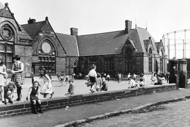
1. Sheepscar in the 1960s
Pupils in the playground at Sheepscar School pictured in June 1968. The gasometer in the background.
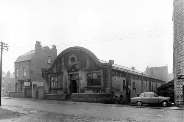
2. Sheepscar in the 1960s
Looking from Armenia Street onto businesses on Manor Street in January 1961. The large building with the curved roof is Morris Brostoff and Sons, bristle manufacturers. Photo: West Yorkshire Archive Service
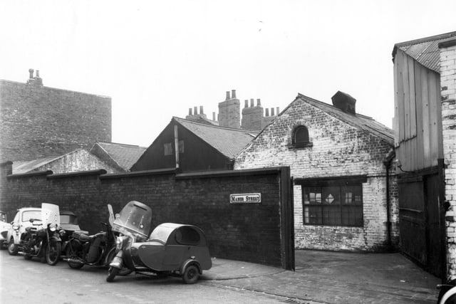
3. Sheepscar in the 1960s
Garages and warehouses on Manor Street pictured in February 1961. Several motorbikes with sidecars are parked towards the left. Photo: West Yorkshire Archive Service
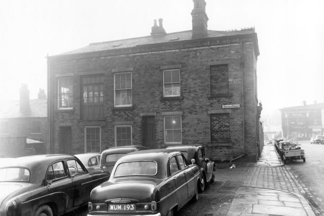
4. Sheepscar in the 1960s
Cars parked in the foreground of this view stand where the odd numbered side of Renfield Street was before slum clearance. Pictured in January 1961. Photo: West Yorkshire Archive Service
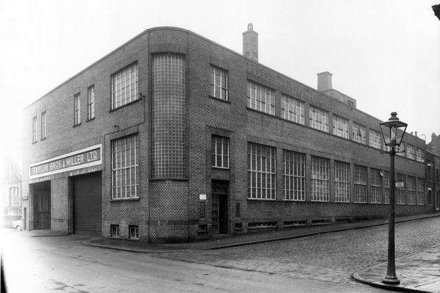
5. Sheepscar in the 1960s
Did you work her back in the day? Taylor Bros. and Miller Ltd on Manor Street builders and plumbers merchants pictured in January 1961. Enfield Road is on the right. Photo: West Yorkshire Archive Service
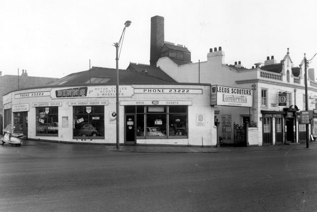
6. Sheepscar in the 1960s
Manor Street and Sheepscar Street South in January 1961. On the left is Binns Scooters, main Lambretta dealers, on Manor Street. On the right is the John Smiths owned Pointer Inn. Photo: West Yorkshire Archive Service