

They feature streets which were included in slum clearance plans for the area as well as shops and local landmarks including the Meanwood Institute. They are published courtesy of photographic archive Leodis, which is run by Leeds Library & Information Service. They also run heritage blog The Secret Library Leeds, which provides a behind the scenes look at the Central Library and highlights from its special collections, including rare books hidden away in the stacks. READ MORE: 12 unseen photos of Headingley down the decades LOVE LEEDS? LOVE NOSTALGIA? Join Leeds Retro on facebook
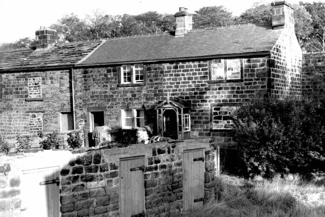
1. Meanwood in the 1960s
Parkside Road in October 1969 In the foreground are the entrances to three outside toilets with wooden doors. Moving back are stone built houses. Photo: Leeds Libraries, www.leodis.net
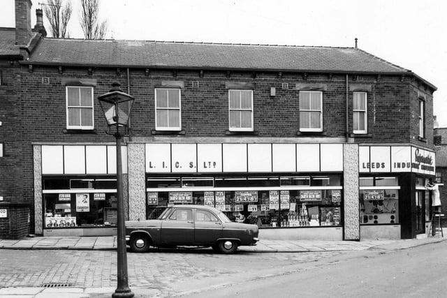
2. Meanwood in the 1960s
March 1966. Green Road is in the foreground of this view, then Greenwood Mount. View shows a Leeds Industrial Co-op Society Ltd Supermarket with a butchers to the front and a bakers at the back. Photo: Leeds Libraries, www.leodis.net
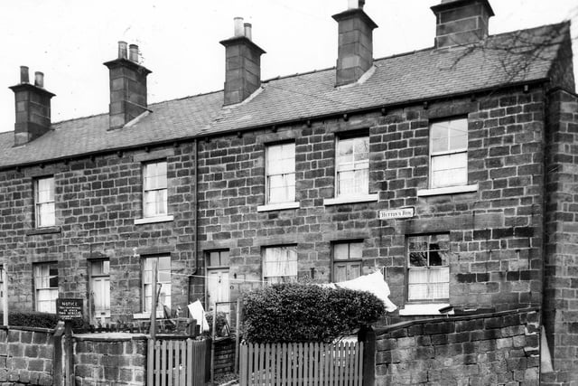
3. Meanwood in the 1960s
March 1966. Odd and even numbered houses on Hutton's Row. These houses had gardens to the front and windows but no doors to the rear. They were included in slum clearance plans for the Green Road area. Photo: Leeds Libraries, www.leodis.net
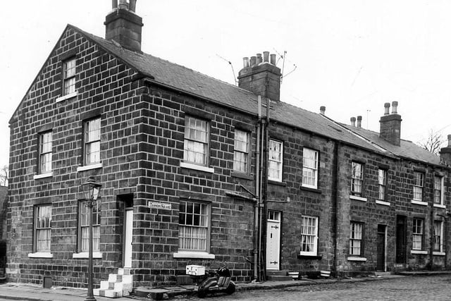
4. Meanwood in the 1960s
March 1966. Green Road stands to the left of this view and Tannery Square runs to the right. Photo: Leeds Libraries, www.leodis.net
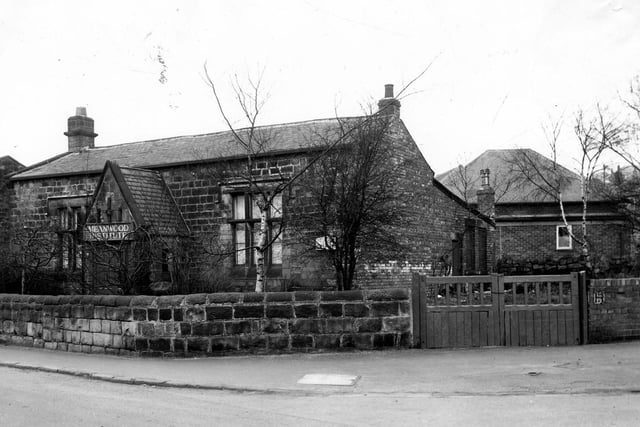
5. Meanwood in the 1960s
The Meanwood Institute on Green Road pictured in March 1966. This had been number 42 until recent renumbering of the even numbered side of the street made it number 92. Photo: Leeds Libraries, www.leodis.net
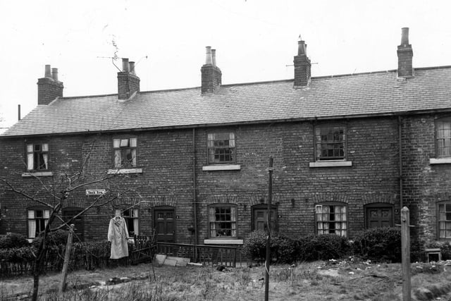
6. Meanwood in the 1960s
Houses on Brick Row pictured in March 1966. Properties have gardens to the front with back doors opening onto a small pathway to the rear. They were included in slum clearance plans for the Green Road area. Photo: Leeds Libraries, www.leodis.net