

These images provide a fascinating snapshot of life in the area and are published courtesy of photographic archive Leodis, which is run by Leeds Library & Information Service. They also run heritage blog The Secret Library Leeds, which provides a behind the scenes look at the Central Library and highlights from its special collections, including rare books hidden away in the stacks. READ MORE: Fantastic photos show life in Leeds during the 1910s
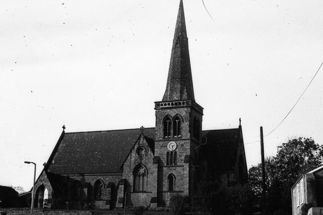
1. Woodlesford Church
This undated photo shows the Church before the road layout in front of it was altered in the 1970s. The church is now a private house, having had the spire dismantled in 2003 as parth of the building conversion. Photo: Leeds Libraries, www.leodis.net
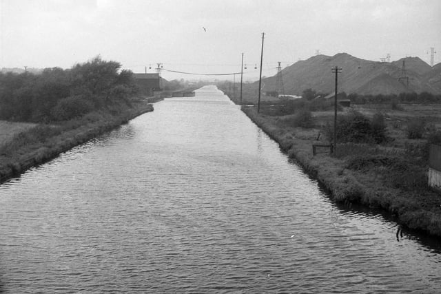
2. Boat Staithe, Fleet Lane
An undated view of the coal staithe on the Aire & Calder Navigation, near Fleet Lane. On the right can be seen the spoil from Water Haigh Colliery. The coal was loaded onto the waiting barges known as 'Tom Puddings' Photo: Leeds Libraries, www.leodis.net
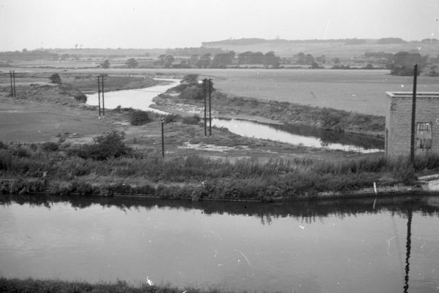
3. Aire & Calder Navigation
An undated view of the Aire & Calder Navigation and River Aire looking from Woodlesford Lock.In the distance, on the right, is Waterloo Main colliery, and the wooded ridge seen behind it is part of the Temple Newsam estate. Photo: Leeds Libraries, www.leodis.net
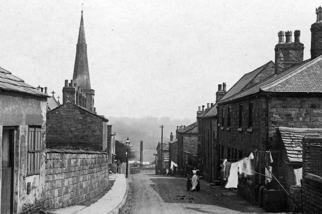
4. Church Street
Church Street looking north-east from the junction with Highfield Lane. On the left can be seen the spire of All Saint's Church, and just uphill from it, the Tow Pointers Inn. Undated. Photo: Leeds Libraries, www.leodis.net
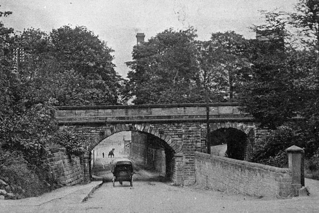
5. Railway Bridge, Wakefield Road
The bridge was constructed in 1838 to take the then Midland Railway over the turnpike road. The turning into Station Lane can just be seen on the left. Photo: Leeds Libraries, www.leodis.net
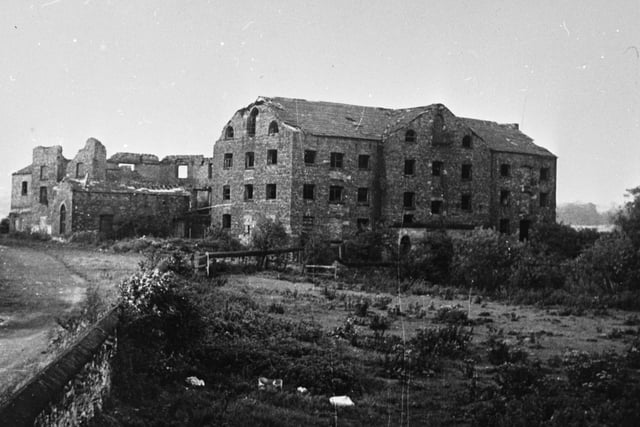
6. Fleet Mills
The ruins of Fleet Mills on Fleet Lane. The mill ground corn, flint and whiting, and occupied an extensive area on the River Aire, but after a serious fire in 1926 never reopened. Photo: Leeds Libraries, www.leodis.net