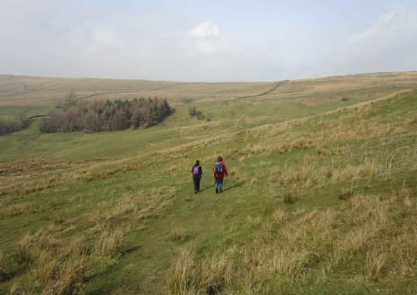
Walking: Amid the stately peaks of the Yorkshire Dales


Those robust fells include Wether Fell (2,041ft), Dodd Fell (2,192ft), Widdale Fell (2,010ft), Lovely Seat (2,231ft) and Great Shunner Fell (2,340ft), all of which are visible from this tremendous circuit which, although tripping along in the shadow of the high ground, hardly raises itself from the valley floor.
Despite its weathered appearance, Hawes is not an ancient settlement when compared to other communities in Wensleydale. Markets were up and running at Askrigg and Wensley centuries before Hawes acquired its charter in 1699.
Advertisement
Hide AdAdvertisement
Hide AdThe town takes its name from the Norse hause, a pass. It first appears in records of the early 1300s when the Normans styled it Le Thouse (The Haws), meaning a pass through the hills. In those early days, Hawes was nothing more than a tiny cluster of farmsteads.


The market charter of 1699 marked the start of the community’s rise to prominence. And when the Lancaster-Richmond turnpike arrived via Ribblehead and Widdale in 1795 allowing wagons, other than pack animals, to reach this quiet backwater, its future was assured. As Hawes grew in stature, so Askrigg and other communities withered. Quarrying, coal mining, spinning, hand-knitting and rope-making augmented Hawes’s mainstay industry of agriculture.
On the arrival of the railway from Northallerton in 1878, Hawes boomed, so much so that a rival railway company, the Midland, built a spur to the town from the Settle-Carlisle line in the other direction – thus, Hawes was served by a railway from east and west. The town lost its railways in 1954, but the station lives on as the Dales Countryside Museum which also houses the Yorkshire Dales National Park visitor centre.
Hawes thrives today on its tourist trade and its popular livestock market, which is one of the biggest in the north of England. Up to 200,000 sheep and 10,000 head of cattle pass through the auction mart every year, attracting farmers and dealers from the furthest corners of the Dales.
THE WALK


HAWES and HARDRAW
Advertisement
Hide AdAdvertisement
Hide Ad7 miles: Allow 3 – 4 hours. Map: O/S OL30 Yorkshire Dales Northern and Central areas.
Park by the side of the A684 near the centre of Hawes when entering from the direction of Leyburn, the best place being near the rope maker’s and the old chapel (now a gallery).
Set out along the A684 (pavement) towards Leyburn, past the auction mart, to a fingerpost just before Wensleydale Press and take the flagstone path for Burtersett with shapely Yorburgh (1,673ft) to your front right and the long ridge of Wether Fell to its right.
At end of field – just before road – turn left through gated gap stile, then cross the Gayle road half left to a fingerpost and then go half left for Burtersett, through next gated stile. Continue on flagstones over several fields to, eventually, climb up towards the houses of Burtersett.
Advertisement
Hide AdAdvertisement
Hide AdJust before the village, look out keenly for a gated gap stile on your left, pass through and continue on flagstones to enter Burtersett at a house with white gable end. On arriving in road, turn right for about 60 yards to a “Y” fork in the road and bear right, past the Burtersett Institute and a “No through road” sign. Ignore fingerpost for Wether Fell on your left – go straight on along the road to enter a walled track (Shaws Lane) within a few yards.
Now stride out on a very enjoyable section with, across the valley to your right, the huge bulk of Abbotside Common, the high point of which is the 2,000-footer, Lovely Seat. To its left is the long ridge of Great Shunner Fell and, left again, Cotter End. At end of walled track, continue by wall along vehicle tracks, past a barn, and then leave the wall to go slightly right to a gate in wall ahead with gap stile. Go straight on to next gated stile and continue - in a more-or-less straight line – over the fields with the long ridge of Ten End (1,870ft), the northern spur of Dodd Fell, to your front left and with Widdale Fell straight ahead. Wether Fell opens up to your left.
No description is needed on this section – just suss out the stile or gate ahead when entering each field. Eventually, with Gayle down to your right, you will enter vehicle tracks – STOP! Spot the wall corner on your right with a waymarked stile tucked away just beyond wall corner. Don’t miss this turn!
1: After crossing the stile, follow wall on your right, through a stile, and then go a quarter left down the field towards Gayle to spot a wall corner. Go round wall corner, down to a gated stile, enter road and turn right into village, soon with the tower of Hawes church visible ahead.
Advertisement
Hide AdAdvertisement
Hide AdSweep left for Hawes over a road bridge (red phone box) and then, almost immediately, as road sweeps right for Hawes, turn left along minor road, past red post box in wall, and then passing Methodist chapel to gain a stone bungalow called Park View on your right. Here, turn right at fingerpost for Mossy Lane to enter field and then turn left across field to a gated stile to the right of a huge tree with a barn beyond.
Go past the barn to an immediate three-sided fingerpost at barn corner – don’t overshoot it! - and bear right, through gate, and onward, past arrow, past another barn to next arrow and cross the plank bridge. Go through a gate and turn a quarter left across the field to a gap stile (yellow tape). Go straight across next field, passing to left of barns, to find a hidden stile. Enter Mossy Lane and turn right for 100 yards to fingerpost on your left for Thorney Mire House.
Take this path and go a quarter right over field (fingerpost out of line!) to a gate with stile to its right. Pass through and go half right across the field corner to next gated stile and continue in same diagonal line, through opening in wall, and then go slightly right over brow of field to spot a gated stile and fingerpost giving access to the B6255 Hawes-Ribblehead road.
Turn left along road for 40 yards and then turn right at fingerpost, through gate and continue by the wall, soon turning right round wall corner to continue along a very wide green lane. Stay close to wall on your left. You will pick up a lovely green path with wall a few yards to your left.
Advertisement
Hide AdAdvertisement
Hide AdAfter a couple of hundred yards – stay alert! - there is a vague fork in the green track with fingerpost visible ahead and a flattened barn in field down to your right. Take the right branch to close with the wall to gain marker post (yellow tape) at gap in wall. Ignore arrow. Instead, go through the gap and turn RIGHT down a diagonal path to a walkers’ gate, pass through and then turn left – ignore gate ahead – past the flattened barn (fingerpost: Lanacar Lane) to a gateway and stile.
Pass through and go half left up the slope, over the brow, to pass a marker post and follow the broad green track to enter Lanacar Lane and turn right. Race down the hill, under the Appersett Viaduct which once carried a spur line of the Settle-Carlisle railway from Garsdale Head to Hawes.
Press on into Appersett with the Widdale Beck down to your left. On arriving in the A684 in Appersett, turn left over road bridge and then, on passing farmyard gate, go through gap stile on your left at fingerpost for Mossdale Head and turn right along wall. Follow wall and then keep going, over footbridge, to ladder stile and, here, enter the road and turn left over bridge.
Continue on road for about 100 yards, turn right into the Hardraw road and take the gap stile opposite (fingerpost: Bluebell Hill). Go straight across field to gate (yellow tape) and then go half left up slope to next gate and continue to a marker post and go straight on aiming for ladder stile in distance.
Advertisement
Hide AdAdvertisement
Hide Ad2: On arriving at a three-sided fingerpost before the ladder stile, turn RIGHT to a gated stile in wall ahead, cross it and go straight ahead, closing with the fence on your right, to spot a yellow-topped post at stile in fence. Cross it and turn left, over a ladder stile, and go straight on with Hardraw popping into view ahead.
The grass path then goes slightly right to pass along the right edge of a section of reeds – just aim for the centre of Hardraw with a wall 30 yards to your right. Now spot the gate to your front left. Descend to it, cross the stile to left of gate and go straight on to Hardraw to gain a ladder stile at power pole.
Enter vehicle track and turn right to emerge in road at Hardraw and turn left, past tea room and then, on crossing bridge over the Hardraw Beck, just before the Green Dragon, immediately turn right (fingerpost: Pennine Way and Hawes).
But first, you might want to take this opportunity to visit Hardraw Force, the highest single-drop waterfall in England, which is gained through the Green Dragon (£2.50 adults). The 100ft-high waterfall, set in a miniature Gordale Scar, has been the setting of occasional brass-band concerts since 1885 when it was found that the acoustics were near perfect.
Advertisement
Hide AdAdvertisement
Hide AdSo, on turning right at the Pennine Way fingerpost, go through kissing gate and then follow the flagstones over the fields. When flagstones finish, go through a new riders’ gate and turn half right to a waymarked walkers’ gate.
Pass through and turn left along a strong green path with Hawes across to your right. Press on below a limestone outcrop to ladder stile and gate and go straight on with the River Ure to your right.
Go past a fingerpost and straight across field to gate, enter the Hardraw-Hawes road and turn right. Follow it to cross a road bridge and immediately turn left through gap in wall to follow a riverside path with wall to your right. At end of this path, enter road through an old metal gate, cross the road and take the footpath opposite and follow flagstones to enter a road, turn left for a few paces and then turn right into the centre of Hawes. Turn left to regain your vehicle.