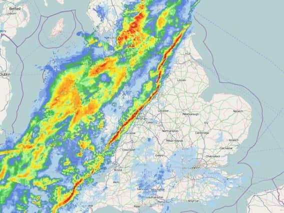
Yorkshire has just been hit by this unusual weather phenomenon


The phenomenon - known as a squall line - passed over the county between 7am and 8am this morning.
A squall line is a thin band of intense rainfall and high winds which sometimes forms ahead of a cold front.
Advertisement
Hide AdAdvertisement
Hide AdThe phenomenon can sometimes lead to frequent lightning, tornadoes and waterspouts. It is also known as a quasi-linear convective system.
The squall line - which is running in a parallel line from the north east of the country down to the south west - has now passed over Yorkshire and is heading towards the north sea.
As the day progresses the weather for Yorkshire will improve with some sunny spells, although there will still be some heavy downpours.
It will feel milder than it has done of late with temperatures reaching 9C.