Weekend weather forecast: Weather warnings for wind in place for Leeds as Storm Freya set to hit


Saturday (2 March)
Saturday is set to be a mixed bag, with sunshine expected throughout the morning, turning to cloud during the afternoon.
The temperature will increase to its peak of 12C by 1pm and remain so throughout the afternoon.
Advertisement
Hide AdAdvertisement
Hide AdLight rain is then set to hit during the evening, from 7pm until around 11pm. The temperature will dip to 8C by 11pm, with an overnight temperature of 6C.
Sunday (3 March)
Sunday will begin cloudy, with the temperature reaching its peak of 9C by 12pm. Heavy rain is then set to hit throughout the afternoon and into the evening, easing off to light rain but continue into the late evening.
The temperature will dip to 7C during the evening, with an overnight temperature of 3C.
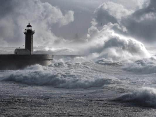
A Met Office yellow weather warning is currently in place for Leeds as Storm Freya is set to hit with gusts of up to 65mph on Sunday afternoon and the early hours of Monday (4 March).
Advertisement
Hide AdAdvertisement
Hide AdThe Met Office said: “Storm Freya will bring very strong winds, with some travel disruption and possible dangerous conditions late Sunday and into Monday.”
“Storm Freya is expected to push quickly north-east across parts of England, Wales and southern Scotland through Sunday afternoon and evening, before clearing into the North Sea through the early part of Monday.
“Gusts of 55-65 mph are likely widely, with the potential for gusts of 70-80 mph for coastal parts of Devon and Cornwall, as well as Irish Sea coasts of Wales and north-west England.”
What to expect from this yellow weather warning:
- Injuries and danger to life from flying debris are possible
Advertisement
Hide AdAdvertisement
Hide Ad- Some damage to buildings and trees, such as tiles blown from roofs and fallen branches, could happen
- Road, rail, air and ferry services may be affected, with longer journey times and cancellations possible
- Some roads and bridges may close
- Power cuts may occur, with the potential to affect other services, such as mobile phone coverage
- Injuries and danger to life could occur from large waves and beach material being thrown onto sea fronts, coastal roads and properties