Hour-by-hour forecast: This is when Storm Gareth will hit Leeds with strong winds and heavy rain


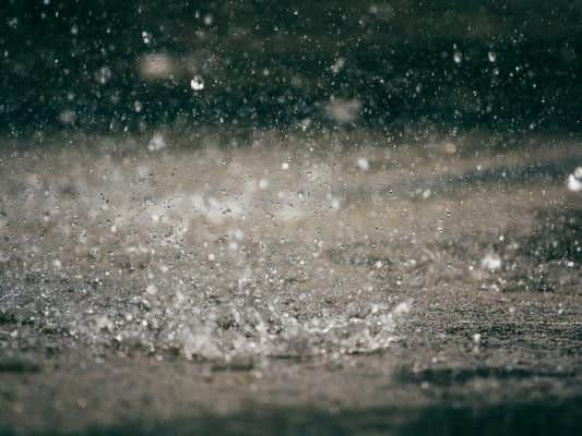
Tuesday (12 March) will be mostly wet and windy, with some periods of cloud and sunny spells.
The evening will see strong winds pick up as Storm Gareth hits. A Met Office yellow weather warning for wind is currently in place from 9pm tonight until 3pm on Wednesday (13 March).
Advertisement
Hide AdAdvertisement
Hide AdThe Met Office said: “Strong west to northwesterly winds are expected from Tuesday afternoon until Wednesday with possible transport disruption.”
What to expect from this weather warning
- Probably some bus and train services affected, with some journeys taking longer
- Delays for high-sided vehicles on exposed routes and bridges likely
- Some short term loss of power and other services is possible
Advertisement
Hide AdAdvertisement
Hide Ad- It's likely that some coastal routes, sea fronts and coastal communities are affected by spray and/or large waves.
Hour-by-hour forecast of when Storm Gareth will hit Leeds with strong winds.
21:00 - Heavy rain, 6C. Wind gust: 47mph
22:00 - Heavy rain, 6C. Wind gust: 47mph
23:00 - Heavy rain, 6C. Wind gust: 49mph
Wednesday (13 March)
00:00 - Heavy rain, 6C. Wind gust: 51mph
01:00 - Heavy rain, 6C. Wind gust: 51mph
02:00 - Heavy rain, 6C. Wind gust: 51mph
03:00 - Heavy rain, 6C. Wind gust: 49mph
04:00 - Heavy rain, 6C. Wind gust: 48mph
05:00 - Heavy shower, 6C. Wind gust: 47mph
06:00 - Heavy shower, 6C. Wind gust: 48mph
07:00 - Light shower, 7C. Wind gust: 48mph
08:00 - Light shower, 7C. Wind gust: 46mph
09:00 - Light shower, 7C. Wind gust: 44mph
10:00 - Sunny day, 8C. Wind gust: 46mph
11:00 - Sunny day, 9C. Wind gust: 46mph
12:00 - Sunny day, 10C. Wind gust: 46mph
13:00 - Sunny intervals, 10C. Wind gust: 44mph
14:00 - Sunny intervals, 10C. Wind gust: 43mph
15:00 - Sunny intervals, 10C. Wind gust: 41mph