Dramatic electric storms batter UK and could be on the way to Yorkshire as weather warning continues


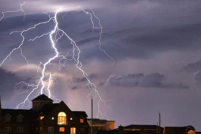
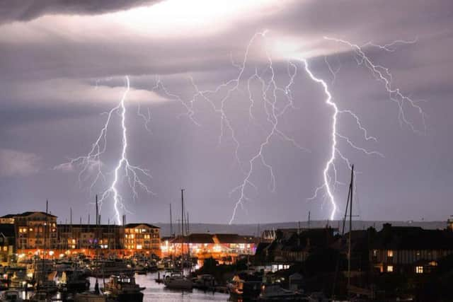
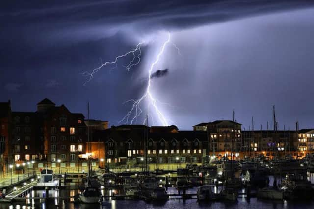
The south of England has been hit with striking electric storms over the past 24 hours, leading to these arresting images of the freak weather.
Torrential rain and a “spectacular electrical storm” lashed parts of the UK overnight as unsettled weather continues to cause disruption across the country.
Advertisement
Hide AdAdvertisement
Hide AdHomes were left without power and roads were flooded in parts of the South East, while Lenham in Kent saw 42mm of rain in the space of just one hour.
The Met Office says thunder and lightning could crash into Yorkshire today.
Police have issued a warning alongside forecasters, telling drivers that roads could be impacted.
A spokesman for Humberside Police said: "The @metoffice have issued a ‘Yellow Warning’ for our area. There may be an impact on driving & travel across the region in the next 24hrs."If you are driving in a storm, SLOW DOWN, put your LIGHTS ON & drive to the conditions #StaySafe #WeatherAware"
Advertisement
Hide AdAdvertisement
Hide AdThe forecast says that Hull, Doncaster, Selby and the coast will be the worst affected areas.
Parts of the edges of Sheffield and South Yorkshire are also included within the warning.
Other parts of Yorkshire like Leeds are expected to avoid the worst of the storms. Leeds will be mostly overcast, while Swaledale in North Yorkshire is expected to see sunshine today.
Advertisement
Hide AdAdvertisement
Hide AdA spokesman for the Met Office said: "Thunderstorms may develop bringing torrential rain, hail and lightning to a few places, with potential disruption to travel and flooding.
"There is a small chance that homes and businesses could be flooded quickly, with damage to some buildings from floodwater, lightning strikes, hail or strong winds
"Where flooding or lightning strikes occur, there is a chance of delays and some cancellations to train and bus services
"Spray and sudden flooding could lead to difficult driving conditions and some road closures
Advertisement
Hide AdAdvertisement
Hide Ad"There is a slight chance that power cuts could occur and other services to some homes and businesses could be lost."
The warning follows a similar warning issued on Tuesday.
The full forecast
Today:
A yellow weather warning for thunder is in place until 9pm on Wednesday.
Cloudy during the morning with outbreaks of rain. Becoming gradually brighter this afternoon with some spells of sunshine developing, but also a few showers. Light winds. Maximum temperature 19 °C.
Tonight:
Sunshine at first this evening with any showers dying away. Dry most of the night with clear spells, although a few showers may spread in from the west before daybreak. Minimum temperature 6 °C.
Thursday:
Advertisement
Hide AdAdvertisement
Hide AdSunny spells and scattered showers through Thursday, perhaps with some heavy bursts at times. Light westerly winds. Becoming mostly dry overnight with clear periods. Maximum temperature 19 °C.
Outlook for Friday to Sunday:
Sunny spells and further isolated showers on Friday. Dry on Saturday with long sunny periods, then dry and bright but becoming cloudier on Sunday.