Travel review: Wolds of wonders - the Viking Way


It sounded like a good idea at the time. Bored with tramping the same old footpaths near to home we thought we might venture forth and tackle something a little more adventurous... a long distance expedition through the heart of rural England.
Going for a walk had generally been a three or four mile affair in the past. Nothing too strenuous – just a gentle stroll through the fields and woods near our home at Letwell in South Yorkshire and we’d be back in time for tea.
Advertisement
Hide AdAdvertisement
Hide AdJess, our energetic border terrier, had admittedly always wanted more. There was no doubting she was in better nick than the pair of us at 65 and 67 respectively, but I fancied we’d be able to keep up with her if we didn’t give in to the blisters.
It was easy enough choosing a suitable route once my wife laid down the ground rules. “I don’t mind walking a long way,” she said, “but don’t ask me to climb up and down lots of big hills.”
The Viking Way fitted the bill perfectly. Just short of 150 miles long, the journey begins beneath the mighty Humber Bridge, and then meanders through the Lincolnshire Wolds to historic Lincoln itself, and then travels ever southward past Belvoir Castle in Leicestershire all the way to the banks of Rutland Water at Oakham.
It was blowing a gale and lashing with rain when we set out from Barton on Humber with Jess inevitably scampering ahead along the south bank of the river. First stop was the visitor centre at Barton Clay Nature Reserve, more to escape the weather than anything else.
Advertisement
Hide AdAdvertisement
Hide AdThe woman behind the counter was full of enthusiasm when she heard about our mission. Turned out she’d attempted the same expedition a few years earlier, but had hung up her boots at Horncastle.
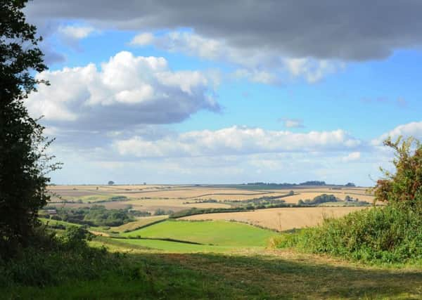
Our aim was to walk once a week tramping eight, ten or 12 miles a time. The walk itself was a joy, travelling through a beautiful and lonely landscape which seemed to have gone unchanged for centuries. Hardly anyone for miles around. No major roads, just green rolling countryside, the occasional wooded hill and views from the top of the Wolds stretching 30 miles or more.
Walking in a straight line can be a messy business when you’re far off the beaten track. Once you’ve parked the car at the end of the route then you need a bus to take you back to the starting line. And double deckers are thin on the ground in deepest rural Lincolnshire.
Taxis looked like the only option – till we heard about Call Connect. Funded by Lincolnshire County Council the service aims to provide transport solutions for people living in isolated communities and a simple registration procedure set us on our way.
Advertisement
Hide AdAdvertisement
Hide AdOne week saw us heading from the village of Tealby – near Market Rasen – to the “lost” medieval hamlet of East Wykeham, miles from anywhere, deep in the Wolds. I felt a mite embarrassed booking the journey, especially when the girl at the end of the phone had to reach for an Ordnance Survey map to find the farm track where we were heading.
Needless to say the bus duly arrived at the right spot at roughly the right time. The driver seemed to be enjoying himself. “Took some finding this place,” he smiled, “but isn’t it a lovely spot...”
We’d taken a policy decision at the outset to stay well away from grazing cattle. Too many stories about ramblers being trampled and even killed by rogue cows. Jess’s presence certainly added to the danger. So when we came upon a herd of heifers and their young blocking the footpath at Normanby le Wold – 550ft high on Lincolnshire’s chalk plateau – there was no argument. A three mile detour beckoned, but better safe than sorry.
Amazing tales of yesteryear unfolded as we pressed on through one unspoilt village after another. Donington on Bain was typical. Hassock throwing was a custom there in the mid-1700s with the elderly womenfolk gathering in church for every wedding. They’d pelt the bride and groom and then throw all the hassocks at one another. The happy chaos was tolerated until a new rector fell victim to an airborne assault, and called a halt to the frivolity.
Advertisement
Hide AdAdvertisement
Hide AdAt beautiful Fulletby we chanced upon a monument to the remarkable Henry Winn. Born in 1816 he left school at 10, was appointed parish clerk at 14, and went on to father 21 children, working at various times as the village grocer, draper, ironmonger, constable and schoolmaster. Somehow Henry also found the time to establish the village library, write poetry, newspaper articles and diaries.
Close to RAF Cranwell and the Roman road Ermine Street we arrived at Byards Leap – scene of a witchcraft legend. A collection of horse-shoes still mark the spot where the infamous crone Old Meg met her demise after going into battle with a soldier astride a horse called Blind Byard.
On we went beyond Grantham journeying along an ancient highway called Sewstern Lane dating back to the Bronze Age. It was once the M1 of its day. But the broad grassy path is deserted today – most of it a nature reserve teeming with rare plant life. We reached Oakham last weekend with a heavy heart. Our 150 mile adventure turned out to be 164 miles in all. But you won’t hear us complaining.
Speak to Jess, and she’ll sign for more of the same anytime soon!