

This 2.5 mile walk was devised by Richard Tyler, of the Headingley Development Trust, which produces the HeadingleyLeeds website. The walk begins at Wrangthorn (Hyde Park Corner), follows old tracks which converged on Wood Mill (Tannery Park), and ends at Weetwood Hall. For more historical detail on the walks features, click here. All photos: Richard Tyler.
1. Headingley Hill ginnel
Begin the walk from Hyde Park Corner down Woodhouse Street (to the right of the Hyde Park pub). Take the first left up Cliff Road, and then left again into Cross Cliff Road. Turn right up Cliff Lane, and pass Grosvenor Park Gardens. The entrance to the Headingley Hill ginnel is on the left.
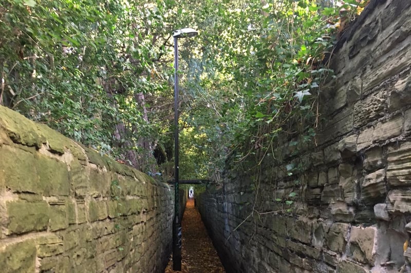
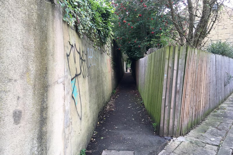
2. Headingley Hill ginnel
Come out into Grosvenor Mount and cross the road diagonally left into the next part of the ginnel, at the back of the Mount gardens. This then opens onto a small triangular grassed area, around a raised bed: from here, cross Grosvenor Road diagonally to the right, to the entrance to the next part of the ginnel. Pass between high stone walls and under the footbridge (pictured) to Cumberland Road, and again cross diagonally to the right to the last, steeply-sloping part of the ginnel. Exit onto Woodhouse Ridge. Turn left, and follow the stone wall on your left, along the old track, with Batty’s Wood on your right, down to the entrance to the Ridge – which is marked by a group of boulders and a threshold stone set in the ground, inscribed ‘Wood House Ridge’.
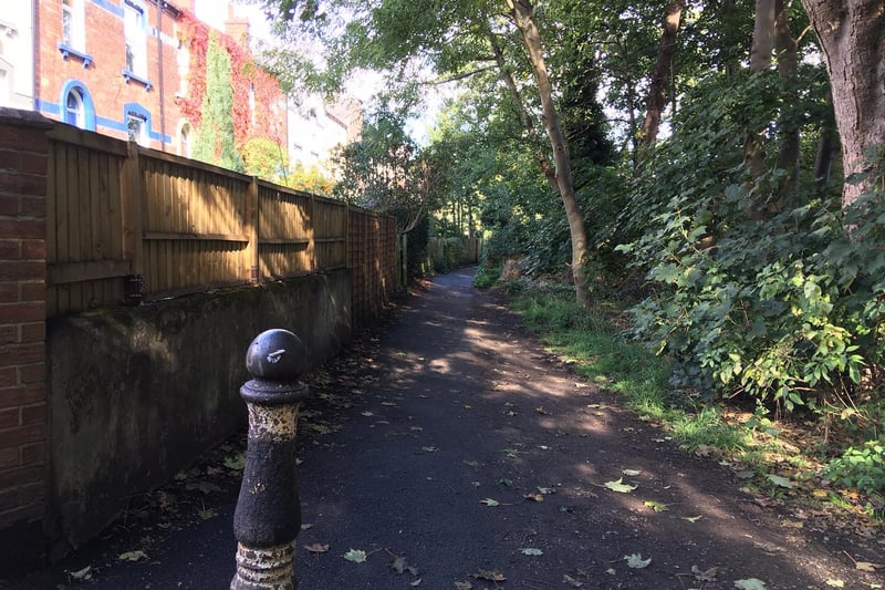
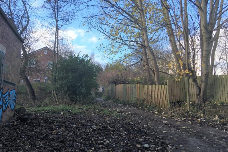
3. Spring Hill ginnel
In front of you, there are three paths. Turn left, passing the Vale Stables garden centre, to re-join the walk at Grove Lane. The middle path continues the walk along the old track across the open space of Cardboard Hill. On the far side, using a couple of flights of steps, cross a sunken path and follow the track between fenced gardens on the left, and a line of trees on the right. Emerge onto Grove Lane. Directly opposite, the track runs ahead, beside the end of Oakfield Terrace. Cross over Grove Lane and follow the track along the front of terraces on the left, which back onto Brookfield Road; on the right is a narrow green corridor, including a pond, with Meanwood Beck on the far side. At the end of the corridor, where it meets Brookfield Road, follow the track into the Spring Hill ginnel (pictured).
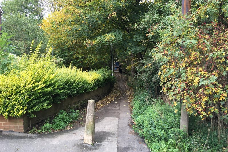
4. Highbury ginnel
Come out onto Monk Bridge Road. Rather than crossing the road directly to Highbury Lane, for safety, turn right for fifty yards or so, to a pedestrian crossing. Return to the Lane, and at the far end of the Lane, directly ahead, enter the continuation of the old track through the Highbury ginnel (pictured). Follow the ginnel for 80 or so yards, with Meanwood Beck on the right at first, and then the tail race of the former mill. The Highbury ginnel and the old track arrive at Wood Mill, and end in a footpath T-junction. The path to the right leads into Tannery Park, on the site of Wood Mill.
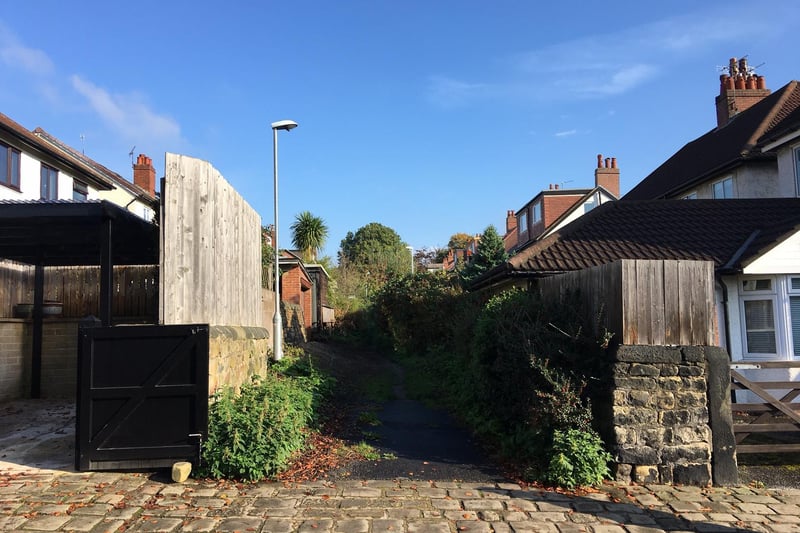
5. School Lane
At the T-junction of footpaths at the end of the Highbury ginnel, the left path is the bottom of another old track to Wood Mill (pictured), known as School Lane. Go up School Lane, with the mill pond behind a wooden fence on your right, until you come to a footpath crossroads. Go straight across the crossroads, and continue on the old track into the middle part of School Lane, between hedges. Exit onto the top of Highbury Mount, and cross diagonally right to the entrance to the final part of School Lane.
6. Headingley Ginnel
Come out where the track joins Monk Bridge Road. Turn right. When the road bends left, keep straight ahead into Moor Road, and then just after Moor Drive, find the entrance to the Headingley Moor ginnel on the right (pictured). Enter the Headingley Moor ginnel, which climbs between inter-war houses, to Moor Park Mount. Cross this road to the north part of the ginnel. Descend the steps, to emerge onto Hollin Drive, between no1 and no2. Pass Hollin Crescent on the left, and continue down the Drive, until it is joined by a footpath from the right, and the road bends to the left.