Easter Weather: More snow forecast for Leeds... but will it just turn out to be heavy rain?


The nine Leeds pubs and bars told to improve their food hygieneThe warning was put in place last week and has remained over the weekend, with the latest Met Office projections suggesting the whole of the west side of Yorkshire is in danger of seeing some snow tomorrow.
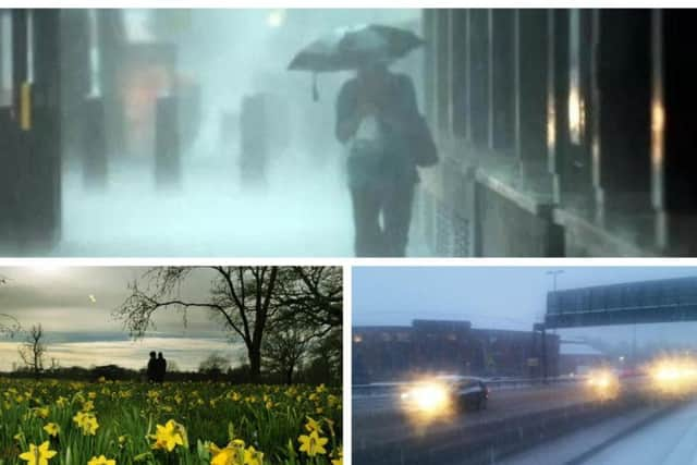
A band of freezing weather and wintry showers is making its way up the country this afternoon and is expected to hit Leeds at about 3am and then stay until long into the evening.
Advertisement
Hide AdAdvertisement
Hide AdTemperatures will struggle to rise above freezing as the Bank Holiday struggles against another icy wintry blast from the Arctic.
Two stabbed in reported robberies in HeadingleyLeeds has already seen two spells of snowy weather in 2018 with the Beast from the East and the Pest from the West causing major traffic delays and school closures.
While the warning for a third storm of snow is very much real, the experts are also making it clear that instead of the white stuff, we will just get rain... and lots of it.
The warning, set for between 3am and midnight on Monday states: "Heavy snow is expected over parts of northern England, especially for high ground.
Advertisement
Hide AdAdvertisement
Hide AdPrice hikes listed: All the prices & charges being increased from today, April 1"As a weather system moves in from the south and comes up against cold air over the UK, rain will turn to heavy snow, mainly on high ground. Between 5 and 10cm of snow is expected to accumulate in places, mainly above 350m, with a smaller chance of 2-5 cm accumulating below this.
"There is also the possibility of a couple of cm of wet snow gather locally at lower levels for a time, before snow turns back to rain.
"Strong winds are also expected which will likely lead to some drifting of snow on the high ground. The snow is likely to be affecting southern parts of the warning area in the early hours of Monday spreading to all parts later on Monday morning.
"Snow is likely to gradually turn to rain even on the highest ground, on Monday afternoon in the southern Pennines. At present there is still some uncertainty in exact snow levels."
The forecast for Leeds looks like this:
Easter Sunday:
Advertisement
Hide AdAdvertisement
Hide AdA rather dull and cloudy start with occasional showers in the morning and some sleet or snow on hills. Showers will gradually ease in the afternoon with brighter spells, however it will stay mostly rather cloudy and chilly. Maximum temperature 7 °C.
Easter Sunday night:
A mostly dry, chilly start to the night with cloud thickening and lowering. After midnight rain, sleet and snow will spread north with snow accumulating on hills. Minimum temperature 0 °C.
Easter Monday:
A mix of rain, sleet and snow will continue with further accumulations across hills. This turning to rain at all levels through the late afternoon and evening, clearing north overnight. Maximum temperature 8 °C.
Outlook for Tuesday to Thursday:
Much milder on Tuesday and Wednesday with rain or showers, perhaps heavy and thundery, although the odd sunny spell. Probably drier on Thursday, although showers still possible, with breezy winds.