

All these images, plucked from YEP archive, featuring all four corners of Leeds including the city centre, Roundhay Park, the University of Leeds as well as Little London and housing estates. And they have one thing in common - they are all undated. Can you help put a year on each photo using the landmarks featured in each? Tell Andrew Hutchinson via: [email protected] READ MORE: Leeds from the air in 2003 - how many of these city landmarks do you recognise?
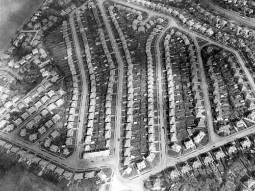
1. Leeds from the air - Carr Manor housing estate
This private suburban estate was built in the 1950s. It is located between Stonegate Road, top left, Scott Hall Road, top right and Stainbeck Road out of the picture below.
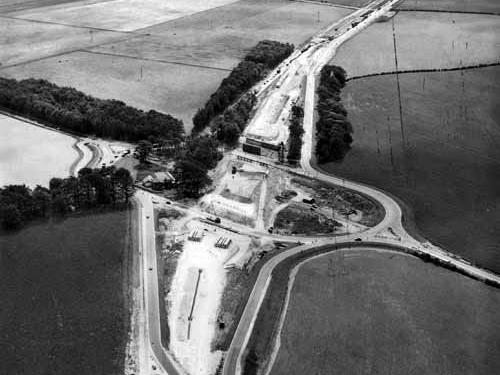
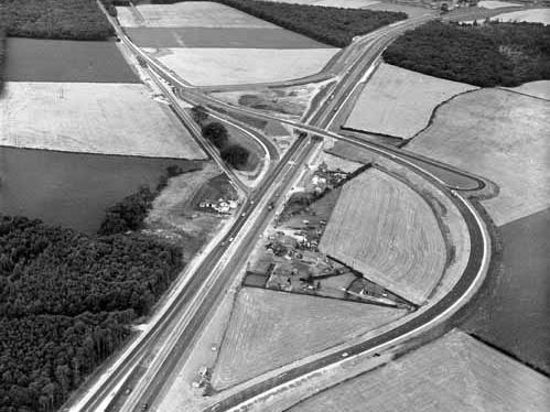
2. Leeds from the air
A1 junction at Boston Spa, with the A1 flyover under construction. The view is looking south with the A1 (Great North Road) running from top to bottom and the A659 from left to right.
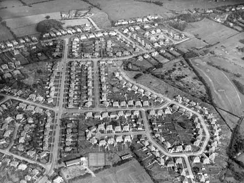
3. Leeds from the air - Alwoodley
Aerial view of an estate of semi-detached housing in Alwoodley. Running vertically up on the left hand side is The Avenue, with The Valley and The Quarry leading off to the left and Meadow Way and The Fairway to the right.
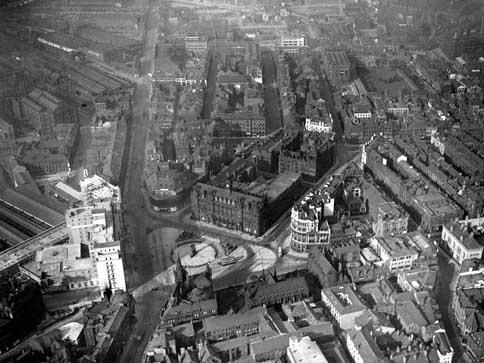
4. Leeds from the air - city centre around City Square
Wellington Street runs vertically on the left and Infirmary Street running diagonally towards the top right. Taken after 1937, when the Queens Hotel, seen on the bottom left, was opened but exact year unknown.
5. Leeds from the air - Micklefield
Great North Road, the A1(T), near Micklefield, seen in the top right hand corner. The Boot & Shoe Inn can be seen in the centre of the photo.
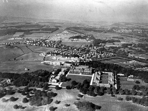
6. Leeds from the air - Headingley
Looking north along Otley Road. The City of Leeds Training College at Beckett Park is in the foreground, with Weetwood Filter Beds to the right.